You are here: Home > Network List > UW - Pacific Northwest Regional Seismic Network Stations List
> Station UMAT Pilot Rock, OR, USA > Earthquake Result Viewer
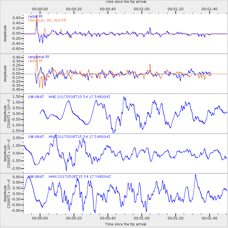
UMAT Pilot Rock, OR, USA - Earthquake Result Viewer
*The percent match for this event was below the threshold and hence no stack was calculated.
| Earthquake location: |
Andreanof Islands, Aleutian Is. |
| Earthquake latitude/longitude: |
51.0/-177.1 |
| Earthquake time(UTC): |
2017/05/08 (128) 15:47:28 GMT |
| Earthquake Depth: |
1.0 km |
| Earthquake Magnitude: |
5.7 Mi |
| Earthquake Catalog/Contributor: |
NEIC PDE/at |
|
| Network: |
UW Pacific Northwest Regional Seismic Network |
| Station: |
UMAT Pilot Rock, OR, USA |
| Lat/Lon: |
45.29 N/118.96 W |
| Elevation: |
1318 m |
|
| Distance: |
38.3 deg |
| Az: |
75.124 deg |
| Baz: |
300.007 deg |
| Ray Param: |
$rayparam |
*The percent match for this event was below the threshold and hence was not used in the summary stack. |
|
| Radial Match: |
87.08175 % |
| Radial Bump: |
400 |
| Transverse Match: |
68.25037 % |
| Transverse Bump: |
400 |
| SOD ConfigId: |
11737051 |
| Insert Time: |
2019-04-27 07:31:54.806 +0000 |
| GWidth: |
2.5 |
| Max Bumps: |
400 |
| Tol: |
0.001 |
|
Signal To Noise
| Channel | StoN | STA | LTA |
| UW:UMAT: :HHZ:20170508T15:54:17.548004Z | 1.003371 | 8.397148E-7 | 8.368936E-7 |
| UW:UMAT: :HHN:20170508T15:54:17.548004Z | 0.9821606 | 5.0011755E-7 | 5.0920136E-7 |
| UW:UMAT: :HHE:20170508T15:54:17.548004Z | 1.863927 | 8.9744543E-7 | 4.81481E-7 |
| Arrivals |
| Ps | |
| PpPs | |
| PsPs/PpSs | |


