You are here: Home > Network List > US - United States National Seismic Network Stations List
> Station WMOK Wichita Mountains, Oklahoma, USA > Earthquake Result Viewer
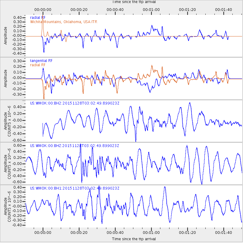
WMOK Wichita Mountains, Oklahoma, USA - Earthquake Result Viewer
*The percent match for this event was below the threshold and hence no stack was calculated.
| Earthquake location: |
Kuril Islands |
| Earthquake latitude/longitude: |
43.3/146.5 |
| Earthquake time(UTC): |
2015/11/28 (332) 02:51:06 GMT |
| Earthquake Depth: |
60 km |
| Earthquake Magnitude: |
5.9 MB |
| Earthquake Catalog/Contributor: |
NEIC PDE/NEIC COMCAT |
|
| Network: |
US United States National Seismic Network |
| Station: |
WMOK Wichita Mountains, Oklahoma, USA |
| Lat/Lon: |
34.74 N/98.78 W |
| Elevation: |
486 m |
|
| Distance: |
82.2 deg |
| Az: |
49.03 deg |
| Baz: |
318.019 deg |
| Ray Param: |
$rayparam |
*The percent match for this event was below the threshold and hence was not used in the summary stack. |
|
| Radial Match: |
52.963448 % |
| Radial Bump: |
400 |
| Transverse Match: |
46.170063 % |
| Transverse Bump: |
400 |
| SOD ConfigId: |
1259291 |
| Insert Time: |
2015-12-12 03:47:31.543 +0000 |
| GWidth: |
2.5 |
| Max Bumps: |
400 |
| Tol: |
0.001 |
|
Signal To Noise
| Channel | StoN | STA | LTA |
| US:WMOK:00:BHZ:20151128T03:02:49.899023Z | 0.82294065 | 2.4880063E-7 | 3.0233122E-7 |
| US:WMOK:00:BH1:20151128T03:02:49.899023Z | 1.081845 | 1.2557366E-7 | 1.1607361E-7 |
| US:WMOK:00:BH2:20151128T03:02:49.899023Z | 1.358813 | 2.7327062E-7 | 2.0110978E-7 |
| Arrivals |
| Ps | |
| PpPs | |
| PsPs/PpSs | |


