You are here: Home > Network List > UU - University of Utah Regional Network Stations List
> Station KNB Kanab, UT, USA > Earthquake Result Viewer
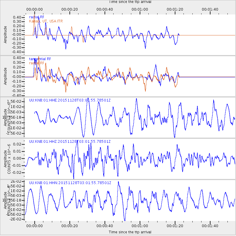
KNB Kanab, UT, USA - Earthquake Result Viewer
*The percent match for this event was below the threshold and hence no stack was calculated.
| Earthquake location: |
Kuril Islands |
| Earthquake latitude/longitude: |
43.3/146.5 |
| Earthquake time(UTC): |
2015/11/28 (332) 02:51:06 GMT |
| Earthquake Depth: |
60 km |
| Earthquake Magnitude: |
5.9 MB |
| Earthquake Catalog/Contributor: |
NEIC PDE/NEIC COMCAT |
|
| Network: |
UU University of Utah Regional Network |
| Station: |
KNB Kanab, UT, USA |
| Lat/Lon: |
37.02 N/112.82 W |
| Elevation: |
1715 m |
|
| Distance: |
72.4 deg |
| Az: |
55.579 deg |
| Baz: |
311.244 deg |
| Ray Param: |
$rayparam |
*The percent match for this event was below the threshold and hence was not used in the summary stack. |
|
| Radial Match: |
69.87411 % |
| Radial Bump: |
400 |
| Transverse Match: |
77.98505 % |
| Transverse Bump: |
340 |
| SOD ConfigId: |
1259291 |
| Insert Time: |
2015-12-12 03:48:02.109 +0000 |
| GWidth: |
2.5 |
| Max Bumps: |
400 |
| Tol: |
0.001 |
|
Signal To Noise
| Channel | StoN | STA | LTA |
| UU:KNB:01:HHZ:20151128T03:01:55.78501Z | 0.5932584 | 4.097291E-9 | 6.9064194E-9 |
| UU:KNB:01:HHN:20151128T03:01:55.78501Z | 1.5952809 | 1.0172339E-8 | 6.3765193E-9 |
| UU:KNB:01:HHE:20151128T03:01:55.78501Z | 3.1422772 | 1.1708452E-8 | 3.726104E-9 |
| Arrivals |
| Ps | |
| PpPs | |
| PsPs/PpSs | |


