You are here: Home > Network List > CI - Caltech Regional Seismic Network Stations List
> Station MPM Manuel Prospect Mine, California, USA > Earthquake Result Viewer
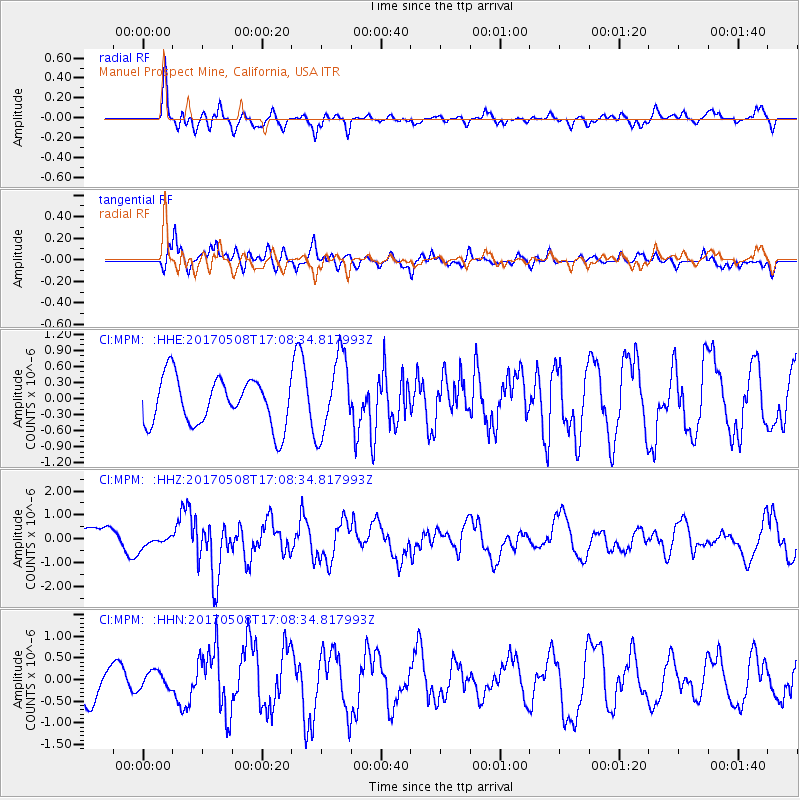
MPM Manuel Prospect Mine, California, USA - Earthquake Result Viewer
*The percent match for this event was below the threshold and hence no stack was calculated.
| Earthquake location: |
Andreanof Islands, Aleutian Is. |
| Earthquake latitude/longitude: |
51.4/-178.6 |
| Earthquake time(UTC): |
2017/05/08 (128) 17:00:42 GMT |
| Earthquake Depth: |
1.0 km |
| Earthquake Magnitude: |
6.6 Mi |
| Earthquake Catalog/Contributor: |
NEIC PDE/at |
|
| Network: |
CI Caltech Regional Seismic Network |
| Station: |
MPM Manuel Prospect Mine, California, USA |
| Lat/Lon: |
36.06 N/117.49 W |
| Elevation: |
185 m |
|
| Distance: |
45.4 deg |
| Az: |
84.974 deg |
| Baz: |
309.563 deg |
| Ray Param: |
$rayparam |
*The percent match for this event was below the threshold and hence was not used in the summary stack. |
|
| Radial Match: |
59.757557 % |
| Radial Bump: |
400 |
| Transverse Match: |
56.86384 % |
| Transverse Bump: |
400 |
| SOD ConfigId: |
11737051 |
| Insert Time: |
2019-04-27 07:37:12.754 +0000 |
| GWidth: |
2.5 |
| Max Bumps: |
400 |
| Tol: |
0.001 |
|
Signal To Noise
| Channel | StoN | STA | LTA |
| CI:MPM: :HHZ:20170508T17:08:34.817993Z | 0.6015683 | 2.6683625E-7 | 4.435677E-7 |
| CI:MPM: :HHN:20170508T17:08:34.817993Z | 0.50678396 | 1.9611241E-7 | 3.8697436E-7 |
| CI:MPM: :HHE:20170508T17:08:34.817993Z | 1.8975179 | 7.336773E-7 | 3.8665107E-7 |
| Arrivals |
| Ps | |
| PpPs | |
| PsPs/PpSs | |


