You are here: Home > Network List > TA - USArray Transportable Network (new EarthScope stations) Stations List
> Station 230A Sterling City, TX, USA > Earthquake Result Viewer
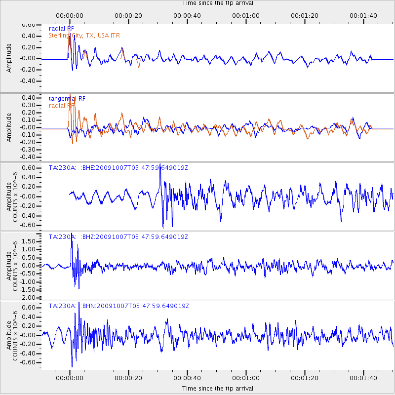
230A Sterling City, TX, USA - Earthquake Result Viewer
*The percent match for this event was below the threshold and hence no stack was calculated.
| Earthquake location: |
Rat Islands, Aleutian Islands |
| Earthquake latitude/longitude: |
52.2/178.1 |
| Earthquake time(UTC): |
2009/10/07 (280) 05:38:37 GMT |
| Earthquake Depth: |
138 km |
| Earthquake Magnitude: |
5.6 MB, 5.6 MW, 5.6 MW |
| Earthquake Catalog/Contributor: |
WHDF/NEIC |
|
| Network: |
TA USArray Transportable Network (new EarthScope stations) |
| Station: |
230A Sterling City, TX, USA |
| Lat/Lon: |
31.89 N/101.11 W |
| Elevation: |
742 m |
|
| Distance: |
60.2 deg |
| Az: |
75.503 deg |
| Baz: |
315.48 deg |
| Ray Param: |
$rayparam |
*The percent match for this event was below the threshold and hence was not used in the summary stack. |
|
| Radial Match: |
59.760826 % |
| Radial Bump: |
400 |
| Transverse Match: |
54.393467 % |
| Transverse Bump: |
400 |
| SOD ConfigId: |
2622 |
| Insert Time: |
2010-03-05 23:41:28.503 +0000 |
| GWidth: |
2.5 |
| Max Bumps: |
400 |
| Tol: |
0.001 |
|
Signal To Noise
| Channel | StoN | STA | LTA |
| TA:230A: :BHZ:20091007T05:47:59.649019Z | 8.869406 | 6.8656965E-7 | 7.740875E-8 |
| TA:230A: :BHN:20091007T05:47:59.649019Z | 2.4023514 | 2.8893507E-7 | 1.2027178E-7 |
| TA:230A: :BHE:20091007T05:47:59.649019Z | 3.0238621 | 2.7987886E-7 | 9.255676E-8 |
| Arrivals |
| Ps | |
| PpPs | |
| PsPs/PpSs | |


