You are here: Home > Network List > TA - USArray Transportable Network (new EarthScope stations) Stations List
> Station T25A Trinidad, CO, USA > Earthquake Result Viewer
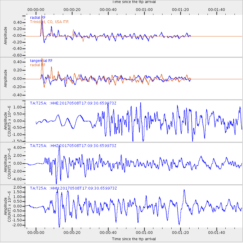
T25A Trinidad, CO, USA - Earthquake Result Viewer
*The percent match for this event was below the threshold and hence no stack was calculated.
| Earthquake location: |
Andreanof Islands, Aleutian Is. |
| Earthquake latitude/longitude: |
51.4/-178.6 |
| Earthquake time(UTC): |
2017/05/08 (128) 17:00:42 GMT |
| Earthquake Depth: |
1.0 km |
| Earthquake Magnitude: |
6.6 Mi |
| Earthquake Catalog/Contributor: |
NEIC PDE/at |
|
| Network: |
TA USArray Transportable Network (new EarthScope stations) |
| Station: |
T25A Trinidad, CO, USA |
| Lat/Lon: |
37.14 N/104.41 W |
| Elevation: |
2017 m |
|
| Distance: |
52.8 deg |
| Az: |
74.917 deg |
| Baz: |
310.739 deg |
| Ray Param: |
$rayparam |
*The percent match for this event was below the threshold and hence was not used in the summary stack. |
|
| Radial Match: |
74.91186 % |
| Radial Bump: |
368 |
| Transverse Match: |
64.32253 % |
| Transverse Bump: |
367 |
| SOD ConfigId: |
11737051 |
| Insert Time: |
2019-04-27 07:43:48.276 +0000 |
| GWidth: |
2.5 |
| Max Bumps: |
400 |
| Tol: |
0.001 |
|
Signal To Noise
| Channel | StoN | STA | LTA |
| TA:T25A: :HHZ:20170508T17:09:30.659973Z | 1.0725101 | 3.0689245E-7 | 2.8614411E-7 |
| TA:T25A: :HHN:20170508T17:09:30.659973Z | 0.49866405 | 1.03563046E-7 | 2.07681E-7 |
| TA:T25A: :HHE:20170508T17:09:30.659973Z | 0.82194334 | 1.8164529E-7 | 2.2099489E-7 |
| Arrivals |
| Ps | |
| PpPs | |
| PsPs/PpSs | |


