You are here: Home > Network List > TA - USArray Transportable Network (new EarthScope stations) Stations List
> Station A21K Barrow, AK, USA > Earthquake Result Viewer
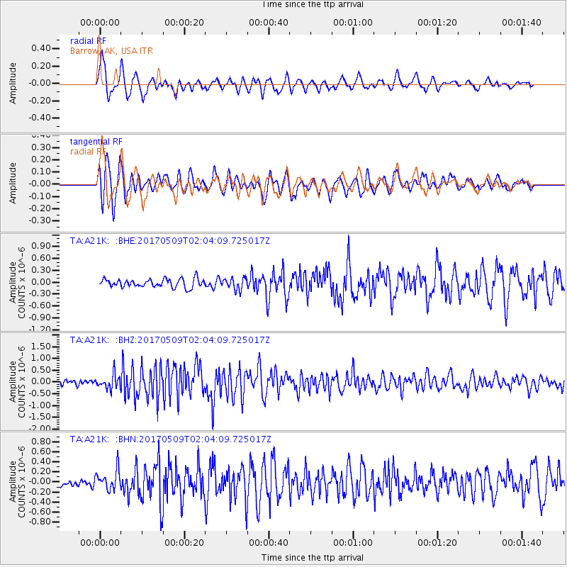
A21K Barrow, AK, USA - Earthquake Result Viewer
*The percent match for this event was below the threshold and hence no stack was calculated.
| Earthquake location: |
Ryukyu Islands, Japan |
| Earthquake latitude/longitude: |
24.4/126.3 |
| Earthquake time(UTC): |
2017/05/09 (129) 01:54:14 GMT |
| Earthquake Depth: |
10 km |
| Earthquake Magnitude: |
6.0 Mww |
| Earthquake Catalog/Contributor: |
NEIC PDE/us |
|
| Network: |
TA USArray Transportable Network (new EarthScope stations) |
| Station: |
A21K Barrow, AK, USA |
| Lat/Lon: |
71.32 N/156.62 W |
| Elevation: |
577 m |
|
| Distance: |
62.9 deg |
| Az: |
20.652 deg |
| Baz: |
266.128 deg |
| Ray Param: |
$rayparam |
*The percent match for this event was below the threshold and hence was not used in the summary stack. |
|
| Radial Match: |
76.540665 % |
| Radial Bump: |
400 |
| Transverse Match: |
66.79042 % |
| Transverse Bump: |
400 |
| SOD ConfigId: |
11737051 |
| Insert Time: |
2019-04-27 07:52:21.134 +0000 |
| GWidth: |
2.5 |
| Max Bumps: |
400 |
| Tol: |
0.001 |
|
Signal To Noise
| Channel | StoN | STA | LTA |
| TA:A21K: :BHZ:20170509T02:04:09.725017Z | 2.8737173 | 2.9511742E-7 | 1.0269535E-7 |
| TA:A21K: :BHN:20170509T02:04:09.725017Z | 1.3305092 | 1.9869624E-7 | 1.493385E-7 |
| TA:A21K: :BHE:20170509T02:04:09.725017Z | 1.3903841 | 1.4667148E-7 | 1.054899E-7 |
| Arrivals |
| Ps | |
| PpPs | |
| PsPs/PpSs | |


