You are here: Home > Network List > UW - Pacific Northwest Regional Seismic Network Stations List
> Station FISH Seaside, OR, USA > Earthquake Result Viewer
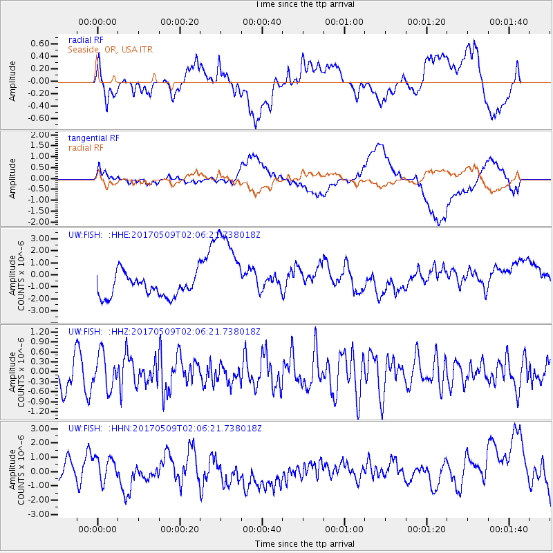
FISH Seaside, OR, USA - Earthquake Result Viewer
*The percent match for this event was below the threshold and hence no stack was calculated.
| Earthquake location: |
Ryukyu Islands, Japan |
| Earthquake latitude/longitude: |
24.4/126.3 |
| Earthquake time(UTC): |
2017/05/09 (129) 01:54:14 GMT |
| Earthquake Depth: |
10 km |
| Earthquake Magnitude: |
6.0 Mww |
| Earthquake Catalog/Contributor: |
NEIC PDE/us |
|
| Network: |
UW Pacific Northwest Regional Seismic Network |
| Station: |
FISH Seaside, OR, USA |
| Lat/Lon: |
45.93 N/123.56 W |
| Elevation: |
325 m |
|
| Distance: |
85.7 deg |
| Az: |
41.078 deg |
| Baz: |
300.899 deg |
| Ray Param: |
$rayparam |
*The percent match for this event was below the threshold and hence was not used in the summary stack. |
|
| Radial Match: |
30.022003 % |
| Radial Bump: |
400 |
| Transverse Match: |
23.912914 % |
| Transverse Bump: |
400 |
| SOD ConfigId: |
11737051 |
| Insert Time: |
2019-04-27 07:53:17.477 +0000 |
| GWidth: |
2.5 |
| Max Bumps: |
400 |
| Tol: |
0.001 |
|
Signal To Noise
| Channel | StoN | STA | LTA |
| UW:FISH: :HHZ:20170509T02:06:21.738018Z | 1.1162884 | 5.266238E-7 | 4.717632E-7 |
| UW:FISH: :HHN:20170509T02:06:21.738018Z | 1.4932858 | 1.0987653E-6 | 7.3580384E-7 |
| UW:FISH: :HHE:20170509T02:06:21.738018Z | 3.810346 | 3.5059554E-6 | 9.2011476E-7 |
| Arrivals |
| Ps | |
| PpPs | |
| PsPs/PpSs | |


