You are here: Home > Network List > TA - USArray Transportable Network (new EarthScope stations) Stations List
> Station 631A Perdido Creek Ranch, Del Rio, TX, USA > Earthquake Result Viewer
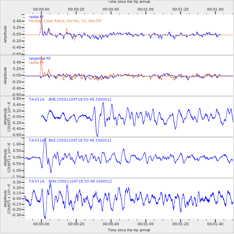
631A Perdido Creek Ranch, Del Rio, TX, USA - Earthquake Result Viewer
*The percent match for this event was below the threshold and hence no stack was calculated.
| Earthquake location: |
Azores Islands Region |
| Earthquake latitude/longitude: |
36.2/-33.9 |
| Earthquake time(UTC): |
2009/11/04 (308) 18:41:44 GMT |
| Earthquake Depth: |
10 km |
| Earthquake Magnitude: |
5.7 MB, 5.6 MS, 5.9 MW, 5.8 MW |
| Earthquake Catalog/Contributor: |
WHDF/NEIC |
|
| Network: |
TA USArray Transportable Network (new EarthScope stations) |
| Station: |
631A Perdido Creek Ranch, Del Rio, TX, USA |
| Lat/Lon: |
29.41 N/100.58 W |
| Elevation: |
344 m |
|
| Distance: |
55.5 deg |
| Az: |
283.523 deg |
| Baz: |
64.403 deg |
| Ray Param: |
$rayparam |
*The percent match for this event was below the threshold and hence was not used in the summary stack. |
|
| Radial Match: |
79.87675 % |
| Radial Bump: |
400 |
| Transverse Match: |
55.85248 % |
| Transverse Bump: |
400 |
| SOD ConfigId: |
2622 |
| Insert Time: |
2010-03-05 23:42:55.755 +0000 |
| GWidth: |
2.5 |
| Max Bumps: |
400 |
| Tol: |
0.001 |
|
Signal To Noise
| Channel | StoN | STA | LTA |
| TA:631A: :BHZ:20091104T18:50:48.399001Z | 9.2848215 | 7.219489E-7 | 7.775582E-8 |
| TA:631A: :BHN:20091104T18:50:48.399001Z | 2.739042 | 1.8203028E-7 | 6.6457645E-8 |
| TA:631A: :BHE:20091104T18:50:48.399001Z | 3.704483 | 3.204805E-7 | 8.6511534E-8 |
| Arrivals |
| Ps | |
| PpPs | |
| PsPs/PpSs | |


