
632A Uvalde, TX, USA - Earthquake Result Viewer
| ||||||||||||||||||
| ||||||||||||||||||
| ||||||||||||||||||
|
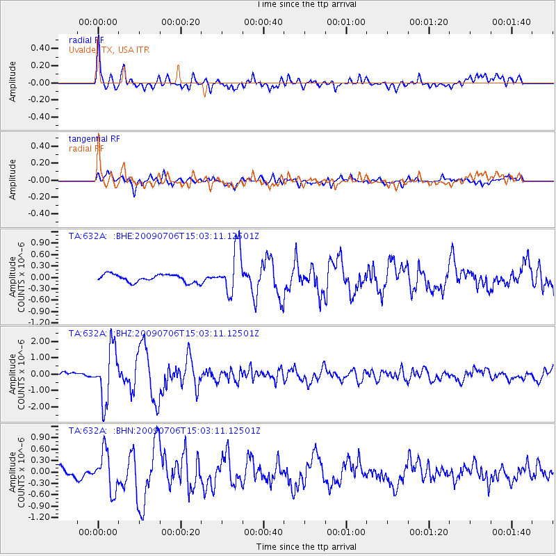
Signal To Noise
| Channel | StoN | STA | LTA |
| TA:632A: :BHZ:20090706T15:03:11.12501Z | 7.9777274 | 1.6577079E-6 | 2.07792E-7 |
| TA:632A: :BHN:20090706T15:03:11.12501Z | 3.2325728 | 5.306427E-7 | 1.6415491E-7 |
| TA:632A: :BHE:20090706T15:03:11.12501Z | 5.959395 | 6.099667E-7 | 1.023538E-7 |
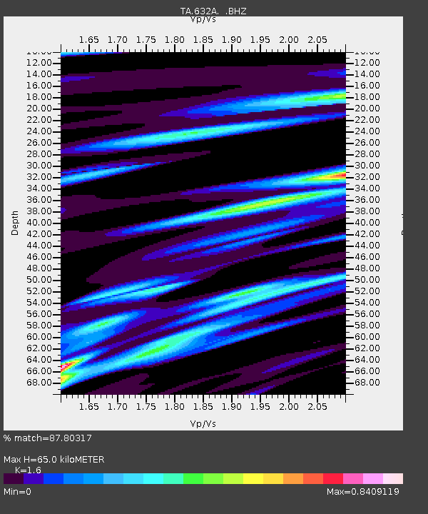
| Arrivals | |
| Ps | 6.4 SECOND |
| PpPs | 25 SECOND |
| PsPs/PpSs | 32 SECOND |

