You are here: Home > Network List > TA - USArray Transportable Network (new EarthScope stations) Stations List
> Station 231A Bronte, TX, USA > Earthquake Result Viewer
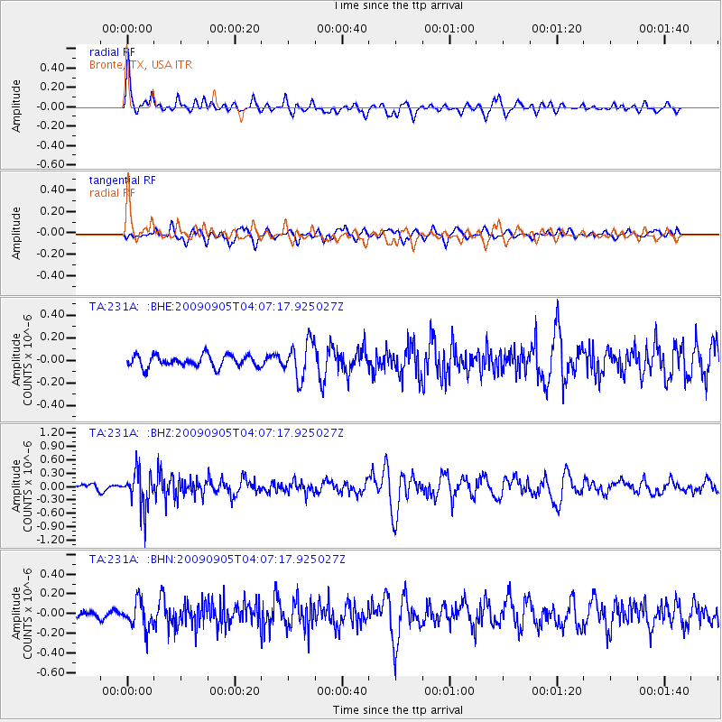
231A Bronte, TX, USA - Earthquake Result Viewer
*The percent match for this event was below the threshold and hence no stack was calculated.
| Earthquake location: |
Southern Peru |
| Earthquake latitude/longitude: |
-15.1/-70.2 |
| Earthquake time(UTC): |
2009/09/05 (248) 03:58:39 GMT |
| Earthquake Depth: |
210 km |
| Earthquake Magnitude: |
5.8 MW, 5.2 MB, 5.8 MW |
| Earthquake Catalog/Contributor: |
WHDF/NEIC |
|
| Network: |
TA USArray Transportable Network (new EarthScope stations) |
| Station: |
231A Bronte, TX, USA |
| Lat/Lon: |
31.94 N/100.32 W |
| Elevation: |
574 m |
|
| Distance: |
55.0 deg |
| Az: |
328.646 deg |
| Baz: |
143.768 deg |
| Ray Param: |
$rayparam |
*The percent match for this event was below the threshold and hence was not used in the summary stack. |
|
| Radial Match: |
67.464806 % |
| Radial Bump: |
331 |
| Transverse Match: |
57.734024 % |
| Transverse Bump: |
400 |
| SOD ConfigId: |
2622 |
| Insert Time: |
2010-03-05 23:44:47.454 +0000 |
| GWidth: |
2.5 |
| Max Bumps: |
400 |
| Tol: |
0.001 |
|
Signal To Noise
| Channel | StoN | STA | LTA |
| TA:231A: :BHZ:20090905T04:07:17.925027Z | 8.338948 | 4.045357E-7 | 4.85116E-8 |
| TA:231A: :BHN:20090905T04:07:17.925027Z | 3.7039363 | 1.4307824E-7 | 3.8628702E-8 |
| TA:231A: :BHE:20090905T04:07:17.925027Z | 3.1852312 | 1.6323862E-7 | 5.12486E-8 |
| Arrivals |
| Ps | |
| PpPs | |
| PsPs/PpSs | |


