You are here: Home > Network List > CI - Caltech Regional Seismic Network Stations List
> Station MPM Manuel Prospect Mine, California, USA > Earthquake Result Viewer
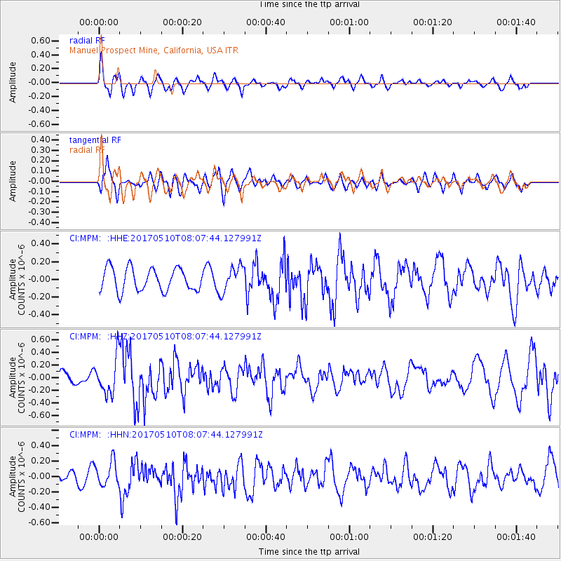
MPM Manuel Prospect Mine, California, USA - Earthquake Result Viewer
*The percent match for this event was below the threshold and hence no stack was calculated.
| Earthquake location: |
Andreanof Islands, Aleutian Is. |
| Earthquake latitude/longitude: |
51.4/-178.5 |
| Earthquake time(UTC): |
2017/05/10 (130) 07:59:55 GMT |
| Earthquake Depth: |
1.0 km |
| Earthquake Magnitude: |
6.0 Mi |
| Earthquake Catalog/Contributor: |
NEIC PDE/at |
|
| Network: |
CI Caltech Regional Seismic Network |
| Station: |
MPM Manuel Prospect Mine, California, USA |
| Lat/Lon: |
36.06 N/117.49 W |
| Elevation: |
185 m |
|
| Distance: |
45.3 deg |
| Az: |
85.145 deg |
| Baz: |
309.676 deg |
| Ray Param: |
$rayparam |
*The percent match for this event was below the threshold and hence was not used in the summary stack. |
|
| Radial Match: |
53.593906 % |
| Radial Bump: |
400 |
| Transverse Match: |
48.069466 % |
| Transverse Bump: |
400 |
| SOD ConfigId: |
11737051 |
| Insert Time: |
2019-04-27 08:12:09.925 +0000 |
| GWidth: |
2.5 |
| Max Bumps: |
400 |
| Tol: |
0.001 |
|
Signal To Noise
| Channel | StoN | STA | LTA |
| CI:MPM: :HHZ:20170510T08:07:44.127991Z | 1.6563127 | 3.0162136E-7 | 1.8210412E-7 |
| CI:MPM: :HHN:20170510T08:07:44.127991Z | 1.3645825 | 1.5737984E-7 | 1.1533186E-7 |
| CI:MPM: :HHE:20170510T08:07:44.127991Z | 1.127688 | 1.4582604E-7 | 1.2931417E-7 |
| Arrivals |
| Ps | |
| PpPs | |
| PsPs/PpSs | |


