You are here: Home > Network List > GS - US Geological Survey Networks Stations List
> Station OK051 E0350 and S34600 Roads, Ralston, OK > Earthquake Result Viewer
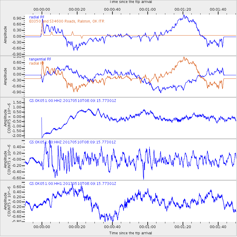
OK051 E0350 and S34600 Roads, Ralston, OK - Earthquake Result Viewer
*The percent match for this event was below the threshold and hence no stack was calculated.
| Earthquake location: |
Andreanof Islands, Aleutian Is. |
| Earthquake latitude/longitude: |
51.4/-178.5 |
| Earthquake time(UTC): |
2017/05/10 (130) 07:59:55 GMT |
| Earthquake Depth: |
1.0 km |
| Earthquake Magnitude: |
6.0 Mi |
| Earthquake Catalog/Contributor: |
NEIC PDE/at |
|
| Network: |
GS US Geological Survey Networks |
| Station: |
OK051 E0350 and S34600 Roads, Ralston, OK |
| Lat/Lon: |
36.51 N/96.84 W |
| Elevation: |
263 m |
|
| Distance: |
57.6 deg |
| Az: |
70.693 deg |
| Baz: |
312.849 deg |
| Ray Param: |
$rayparam |
*The percent match for this event was below the threshold and hence was not used in the summary stack. |
|
| Radial Match: |
39.45324 % |
| Radial Bump: |
400 |
| Transverse Match: |
22.706892 % |
| Transverse Bump: |
400 |
| SOD ConfigId: |
11737051 |
| Insert Time: |
2019-04-27 08:14:15.561 +0000 |
| GWidth: |
2.5 |
| Max Bumps: |
400 |
| Tol: |
0.001 |
|
Signal To Noise
| Channel | StoN | STA | LTA |
| GS:OK051:00:HHZ:20170510T08:09:15.77301Z | 2.8238199 | 3.1243667E-7 | 1.1064327E-7 |
| GS:OK051:00:HH1:20170510T08:09:15.77301Z | 1.4331884 | 2.4653974E-7 | 1.7202187E-7 |
| GS:OK051:00:HH2:20170510T08:09:15.77301Z | 1.2351751 | 1.0840557E-6 | 8.7765346E-7 |
| Arrivals |
| Ps | |
| PpPs | |
| PsPs/PpSs | |


