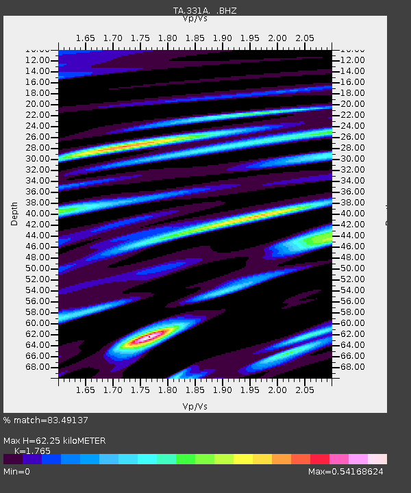
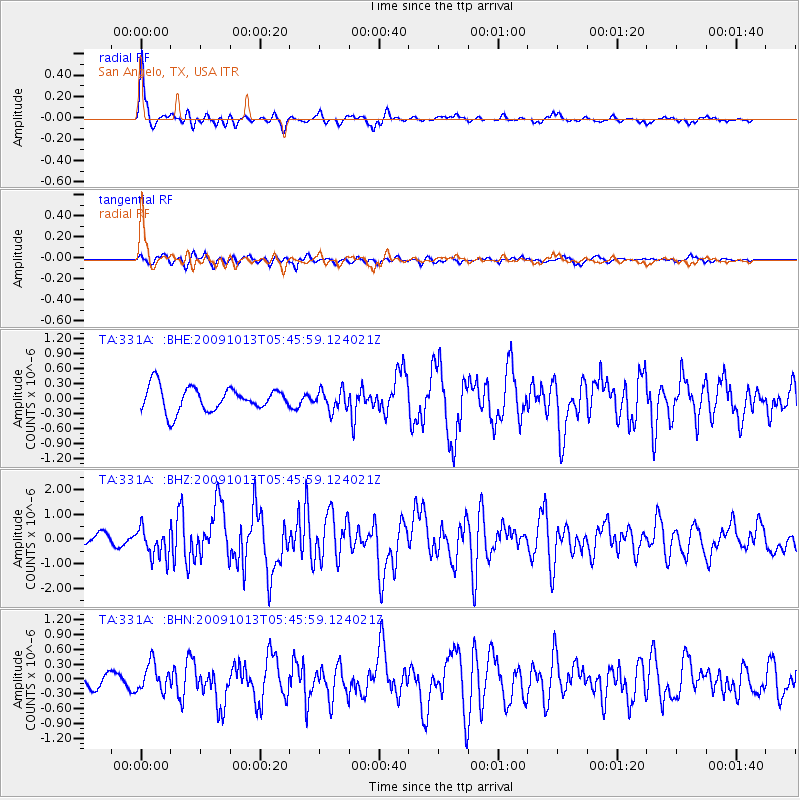
331A San Angelo, TX, USA - Earthquake Result Viewer

Earthquake location: Fox Islands, Aleutian Islands
Earthquake latitude/longitude: 52.8/-167.0
Earthquake time(UTC): 2009/10/13 (286) 05:37:23 GMT
Earthquake Depth: 24 km
Earthquake Magnitude: 6.0 MB, 6.1 MS, 6.5 MW, 6.5 MW
Earthquake Catalog/Contributor: WHDF/NEIC
Network: TA USArray Transportable Network (new EarthScope stations)
Station: 331A San Angelo, TX, USA
Lat/Lon: 31.31 N/100.43 W
Elevation: 615 m
Distance: 51.9 deg
Az: 86.79 deg
Baz: 314.846 deg
Ray Param: 0.06709375
Estimated Moho Depth: 62.25 km
Estimated Crust Vp/Vs: 1.76
Assumed Crust Vp: 6.38 km/s
Estimated Crust Vs: 3.615 km/s
Estimated Crust Poisson's Ratio: 0.26
Radial Match: 83.49137 %
Radial Bump: 309
Transverse Match: 78.95594 %
Transverse Bump: 391
SOD ConfigId: 2622
Insert Time: 2010-03-05 23:45:31.150 +0000
GWidth: 2.5
Max Bumps: 400
Tol: 0.001

Signal To Noise

ChannelStoNSTALTA
TA:331A: :BHZ:20091013T05:45:59.124021Z4.4210476.011532E-71.359753E-7
TA:331A: :BHN:20091013T05:45:59.124021Z1.90997672.8132453E-71.4729213E-7
TA:331A: :BHE:20091013T05:45:59.124021Z0.83051531.9895009E-72.3955016E-7
Arrivals
Ps7.9 SECOND
PpPs26 SECOND
PsPs/PpSs33 SECOND