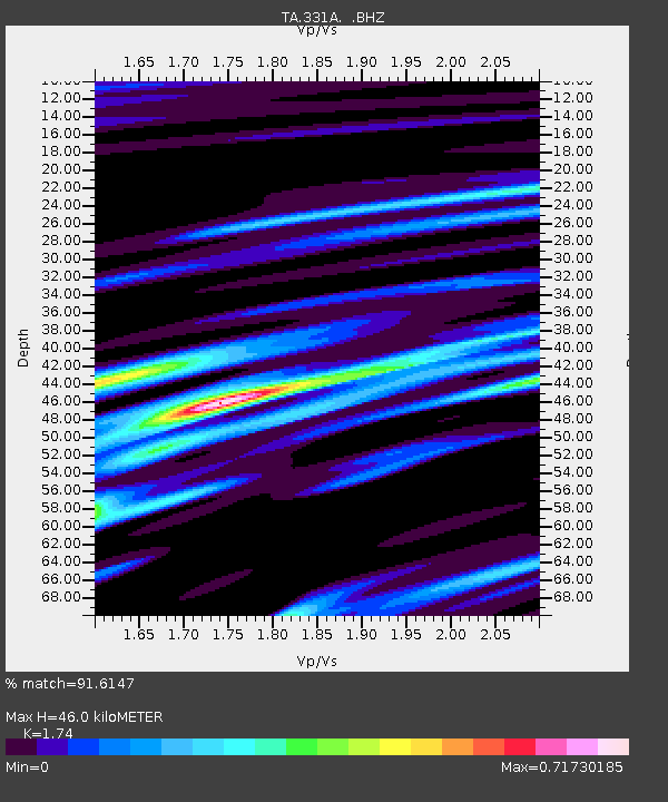
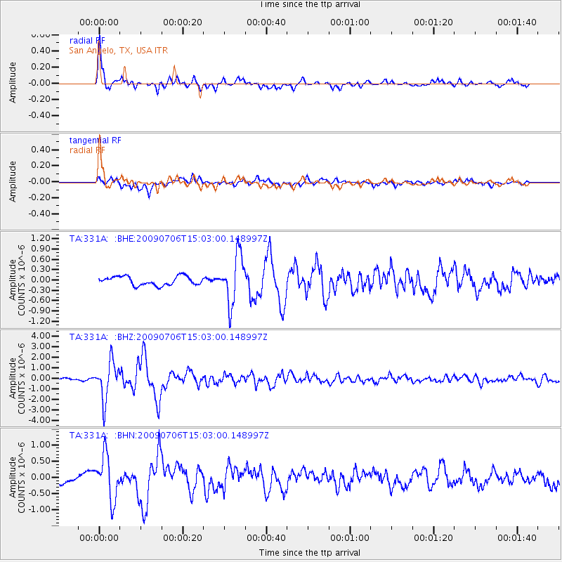
331A San Angelo, TX, USA - Earthquake Result Viewer

Earthquake location: Rat Islands, Aleutian Islands
Earthquake latitude/longitude: 50.4/177.0
Earthquake time(UTC): 2009/07/06 (187) 14:53:12 GMT
Earthquake Depth: 22 km
Earthquake Magnitude: 6.0 MB, 5.8 MS, 6.1 MW, 6.0 MW
Earthquake Catalog/Contributor: WHDF/NEIC
Network: TA USArray Transportable Network (new EarthScope stations)
Station: 331A San Angelo, TX, USA
Lat/Lon: 31.31 N/100.43 W
Elevation: 615 m
Distance: 62.1 deg
Az: 73.854 deg
Baz: 314.138 deg
Ray Param: 0.06043489
Estimated Moho Depth: 46.0 km
Estimated Crust Vp/Vs: 1.74
Assumed Crust Vp: 6.38 km/s
Estimated Crust Vs: 3.667 km/s
Estimated Crust Poisson's Ratio: 0.25
Radial Match: 91.6147 %
Radial Bump: 355
Transverse Match: 82.011314 %
Transverse Bump: 400
SOD ConfigId: 2648
Insert Time: 2010-03-05 23:45:40.905 +0000
GWidth: 2.5
Max Bumps: 400
Tol: 0.001

Signal To Noise

ChannelStoNSTALTA
TA:331A: :BHZ:20090706T15:03:00.148997Z13.9108041.8270288E-61.3133884E-7
TA:331A: :BHN:20090706T15:03:00.148997Z8.1486226.96408E-78.5463284E-8
TA:331A: :BHE:20090706T15:03:00.148997Z5.5838097.171917E-71.2844131E-7
Arrivals
Ps5.6 SECOND
PpPs19 SECOND
PsPs/PpSs24 SECOND