You are here: Home > Network List > TA - USArray Transportable Network (new EarthScope stations) Stations List
> Station 833A Chaparral WMA, Artesia Wells, TX, USA > Earthquake Result Viewer
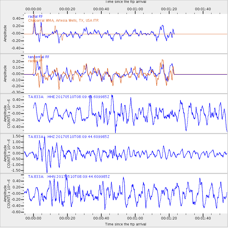
833A Chaparral WMA, Artesia Wells, TX, USA - Earthquake Result Viewer
*The percent match for this event was below the threshold and hence no stack was calculated.
| Earthquake location: |
Andreanof Islands, Aleutian Is. |
| Earthquake latitude/longitude: |
51.4/-178.5 |
| Earthquake time(UTC): |
2017/05/10 (130) 07:59:55 GMT |
| Earthquake Depth: |
1.0 km |
| Earthquake Magnitude: |
6.0 Mi |
| Earthquake Catalog/Contributor: |
NEIC PDE/at |
|
| Network: |
TA USArray Transportable Network (new EarthScope stations) |
| Station: |
833A Chaparral WMA, Artesia Wells, TX, USA |
| Lat/Lon: |
28.32 N/99.39 W |
| Elevation: |
171 m |
|
| Distance: |
61.8 deg |
| Az: |
79.204 deg |
| Baz: |
315.782 deg |
| Ray Param: |
$rayparam |
*The percent match for this event was below the threshold and hence was not used in the summary stack. |
|
| Radial Match: |
59.835934 % |
| Radial Bump: |
382 |
| Transverse Match: |
61.308277 % |
| Transverse Bump: |
400 |
| SOD ConfigId: |
11737051 |
| Insert Time: |
2019-04-27 08:19:48.976 +0000 |
| GWidth: |
2.5 |
| Max Bumps: |
400 |
| Tol: |
0.001 |
|
Signal To Noise
| Channel | StoN | STA | LTA |
| TA:833A: :HHZ:20170510T08:09:44.609985Z | 2.6740856 | 4.5300496E-7 | 1.6940555E-7 |
| TA:833A: :HHN:20170510T08:09:44.609985Z | 1.0593569 | 1.7157375E-7 | 1.6196027E-7 |
| TA:833A: :HHE:20170510T08:09:44.609985Z | 1.6742021 | 2.5621105E-7 | 1.5303472E-7 |
| Arrivals |
| Ps | |
| PpPs | |
| PsPs/PpSs | |


