You are here: Home > Network List > TA - USArray Transportable Network (new EarthScope stations) Stations List
> Station MSTX Muleshoe, TX, USA > Earthquake Result Viewer
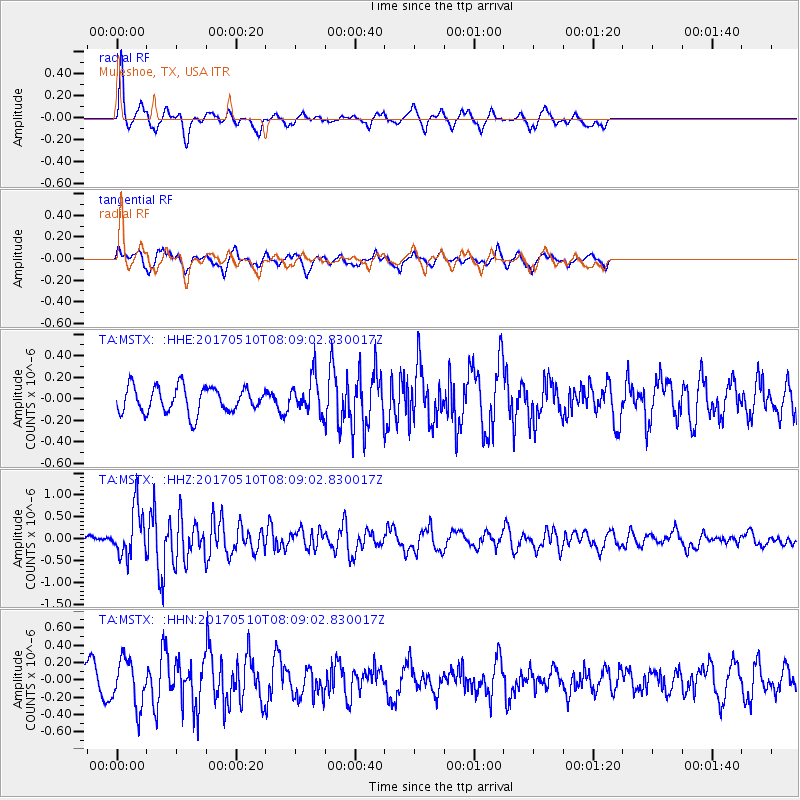
MSTX Muleshoe, TX, USA - Earthquake Result Viewer
*The percent match for this event was below the threshold and hence no stack was calculated.
| Earthquake location: |
Andreanof Islands, Aleutian Is. |
| Earthquake latitude/longitude: |
51.4/-178.5 |
| Earthquake time(UTC): |
2017/05/10 (130) 07:59:55 GMT |
| Earthquake Depth: |
1.0 km |
| Earthquake Magnitude: |
6.0 Mi |
| Earthquake Catalog/Contributor: |
NEIC PDE/at |
|
| Network: |
TA USArray Transportable Network (new EarthScope stations) |
| Station: |
MSTX Muleshoe, TX, USA |
| Lat/Lon: |
33.97 N/102.77 W |
| Elevation: |
1167 m |
|
| Distance: |
55.8 deg |
| Az: |
76.863 deg |
| Baz: |
312.826 deg |
| Ray Param: |
$rayparam |
*The percent match for this event was below the threshold and hence was not used in the summary stack. |
|
| Radial Match: |
68.19826 % |
| Radial Bump: |
306 |
| Transverse Match: |
69.793594 % |
| Transverse Bump: |
395 |
| SOD ConfigId: |
11737051 |
| Insert Time: |
2019-04-27 08:19:59.625 +0000 |
| GWidth: |
2.5 |
| Max Bumps: |
400 |
| Tol: |
0.001 |
|
Signal To Noise
| Channel | StoN | STA | LTA |
| TA:MSTX: :HHZ:20170510T08:09:02.830017Z | 8.343807 | 5.555028E-7 | 6.657665E-8 |
| TA:MSTX: :HHN:20170510T08:09:02.830017Z | 1.504246 | 2.7152075E-7 | 1.8050288E-7 |
| TA:MSTX: :HHE:20170510T08:09:02.830017Z | 1.320099 | 1.5713778E-7 | 1.1903484E-7 |
| Arrivals |
| Ps | |
| PpPs | |
| PsPs/PpSs | |


