You are here: Home > Network List > TA - USArray Transportable Network (new EarthScope stations) Stations List
> Station 331A San Angelo, TX, USA > Earthquake Result Viewer
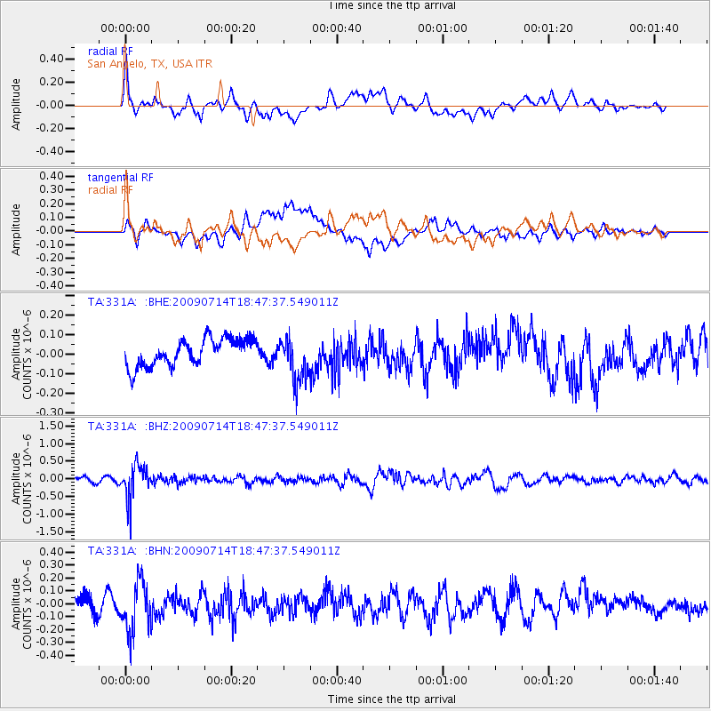
331A San Angelo, TX, USA - Earthquake Result Viewer
*The percent match for this event was below the threshold and hence no stack was calculated.
| Earthquake location: |
Chile-Bolivia Border Region |
| Earthquake latitude/longitude: |
-21.8/-67.1 |
| Earthquake time(UTC): |
2009/07/14 (195) 18:38:08 GMT |
| Earthquake Depth: |
176 km |
| Earthquake Magnitude: |
5.7 MW, 5.4 MB, 5.7 MW |
| Earthquake Catalog/Contributor: |
WHDF/NEIC |
|
| Network: |
TA USArray Transportable Network (new EarthScope stations) |
| Station: |
331A San Angelo, TX, USA |
| Lat/Lon: |
31.31 N/100.43 W |
| Elevation: |
615 m |
|
| Distance: |
61.7 deg |
| Az: |
327.722 deg |
| Baz: |
144.567 deg |
| Ray Param: |
$rayparam |
*The percent match for this event was below the threshold and hence was not used in the summary stack. |
|
| Radial Match: |
71.63139 % |
| Radial Bump: |
400 |
| Transverse Match: |
54.795017 % |
| Transverse Bump: |
400 |
| SOD ConfigId: |
2648 |
| Insert Time: |
2010-03-05 23:46:27.486 +0000 |
| GWidth: |
2.5 |
| Max Bumps: |
400 |
| Tol: |
0.001 |
|
Signal To Noise
| Channel | StoN | STA | LTA |
| TA:331A: :BHZ:20090714T18:47:37.549011Z | 6.832284 | 4.9317174E-7 | 7.218256E-8 |
| TA:331A: :BHN:20090714T18:47:37.549011Z | 2.9229743 | 1.9298348E-7 | 6.602298E-8 |
| TA:331A: :BHE:20090714T18:47:37.549011Z | 1.6615438 | 1.16805765E-7 | 7.029954E-8 |
| Arrivals |
| Ps | |
| PpPs | |
| PsPs/PpSs | |


