
332A Millersview, TX, USA - Earthquake Result Viewer
| ||||||||||||||||||
| ||||||||||||||||||
| ||||||||||||||||||
|
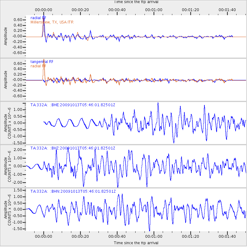
Signal To Noise
| Channel | StoN | STA | LTA |
| TA:332A: :BHZ:20091013T05:46:01.82501Z | 2.9809158 | 4.5433526E-7 | 1.5241466E-7 |
| TA:332A: :BHN:20091013T05:46:01.82501Z | 1.7597464 | 2.8055274E-7 | 1.5942794E-7 |
| TA:332A: :BHE:20091013T05:46:01.82501Z | 0.96027744 | 1.9891455E-7 | 2.0714279E-7 |
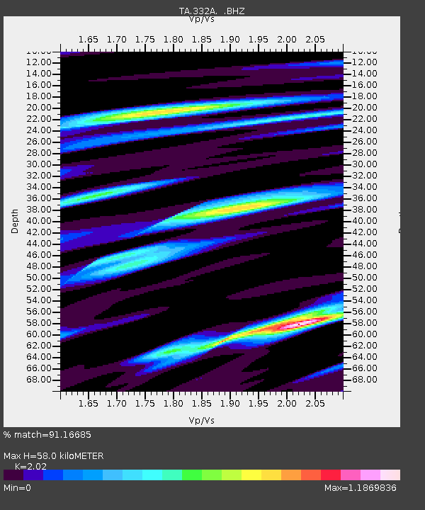
| Arrivals | |
| Ps | 9.6 SECOND |
| PpPs | 26 SECOND |
| PsPs/PpSs | 35 SECOND |

