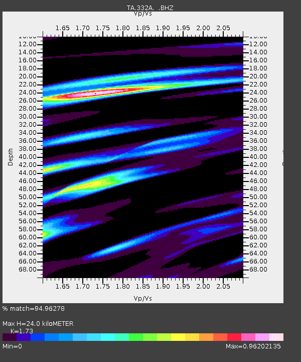
332A Millersview, TX, USA - Earthquake Result Viewer
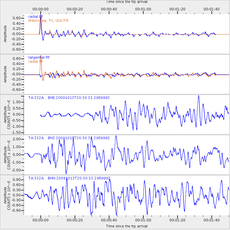
Earthquake location: Fox Islands, Aleutian Islands
Earthquake latitude/longitude: 52.6/-167.1
Earthquake time(UTC): 2009/10/13 (286) 20:21:53 GMT
Earthquake Depth: 14 km
Earthquake Magnitude: 5.9 MB, 6.4 MS, 6.4 MW, 6.4 MW
Earthquake Catalog/Contributor: WHDF/NEIC
Network: TA USArray Transportable Network (new EarthScope stations)
Station: 332A Millersview, TX, USA
Lat/Lon: 31.38 N/99.74 W
Elevation: 513 m
Distance: 52.3 deg
Az: 85.992 deg
Baz: 314.654 deg
Ray Param: 0.06682885
Estimated Moho Depth: 24.0 km
Estimated Crust Vp/Vs: 1.73
Assumed Crust Vp: 6.498 km/s
Estimated Crust Vs: 3.756 km/s
Estimated Crust Poisson's Ratio: 0.25
Radial Match: 94.96278 %
Radial Bump: 307
Transverse Match: 77.739555 %
Transverse Bump: 400
SOD ConfigId: 2622
Insert Time: 2010-03-05 23:46:50.498 +0000
GWidth: 2.5
Max Bumps: 400
Tol: 0.001

Signal To Noise

ChannelStoNSTALTA
TA:332A: :BHZ:20091013T20:30:33.298999Z2.40345574.2056595E-71.7498385E-7
TA:332A: :BHN:20091013T20:30:33.298999Z1.62142611.6392521E-71.01099396E-7
TA:332A: :BHE:20091013T20:30:33.298999Z1.91449681.8255054E-79.5351716E-8
Arrivals
Ps2.9 SECOND
PpPs9.5 SECOND
PsPs/PpSs12 SECOND