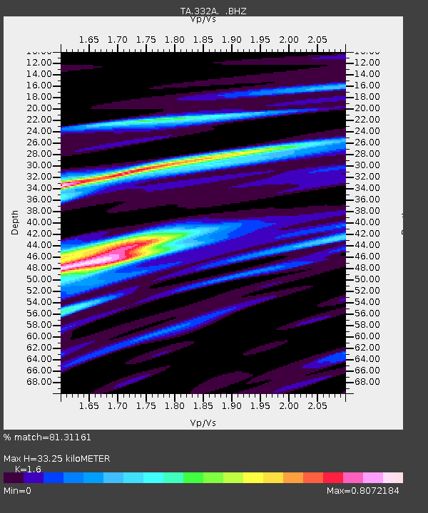
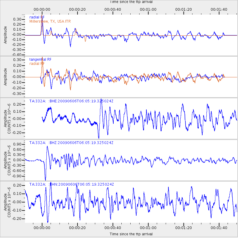
332A Millersview, TX, USA - Earthquake Result Viewer

Earthquake location: Near East Coast Of Honshu, Japan
Earthquake latitude/longitude: 35.5/140.9
Earthquake time(UTC): 2009/06/06 (157) 05:52:43 GMT
Earthquake Depth: 34 km
Earthquake Magnitude: 5.8 MB, 5.4 MS, 5.8 MW, 5.7 MW
Earthquake Catalog/Contributor: WHDF/NEIC
Network: TA USArray Transportable Network (new EarthScope stations)
Station: 332A Millersview, TX, USA
Lat/Lon: 31.38 N/99.74 W
Elevation: 513 m
Distance: 92.4 deg
Az: 48.262 deg
Baz: 314.597 deg
Ray Param: 0.04144643
Estimated Moho Depth: 33.25 km
Estimated Crust Vp/Vs: 1.60
Assumed Crust Vp: 6.498 km/s
Estimated Crust Vs: 4.061 km/s
Estimated Crust Poisson's Ratio: 0.18
Radial Match: 81.31161 %
Radial Bump: 400
Transverse Match: 70.5195 %
Transverse Bump: 400
SOD ConfigId: 2648
Insert Time: 2010-03-05 23:46:55.504 +0000
GWidth: 2.5
Max Bumps: 400
Tol: 0.001

Signal To Noise

ChannelStoNSTALTA
TA:332A: :BHZ:20090606T06:05:19.325024Z14.9437444.7452204E-73.1753892E-8
TA:332A: :BHN:20090606T06:05:19.325024Z2.37078431.3922495E-75.8725274E-8
TA:332A: :BHE:20090606T06:05:19.325024Z2.72938781.5232543E-75.5809377E-8
Arrivals
Ps3.1 SECOND
PpPs13 SECOND
PsPs/PpSs16 SECOND