332A Millersview, TX, USA - Earthquake Result Viewer
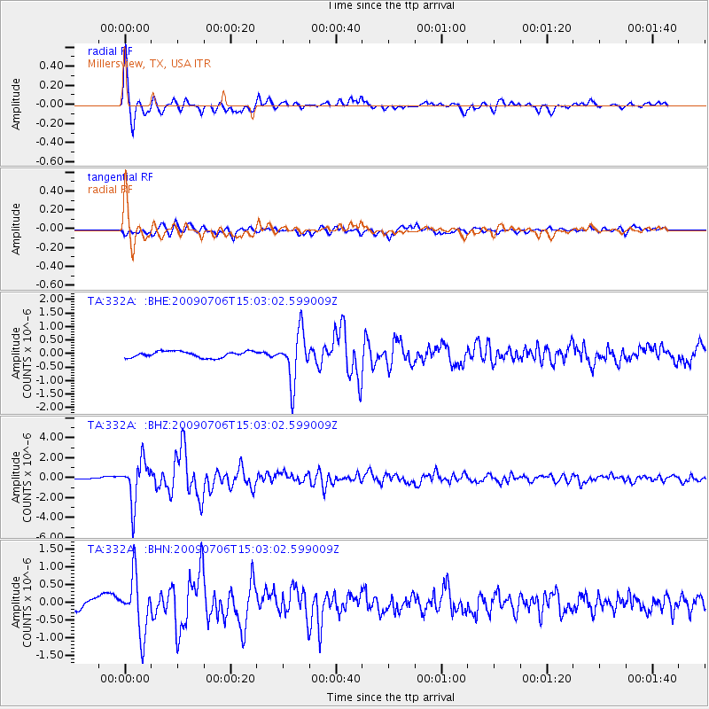
Earthquake location: Rat Islands, Aleutian Islands
Earthquake latitude/longitude: 50.4/177.0
Earthquake time(UTC): 2009/07/06 (187) 14:53:12 GMT
Earthquake Depth: 22 km
Earthquake Magnitude: 6.0 MB, 5.8 MS, 6.1 MW, 6.0 MW
Earthquake Catalog/Contributor: WHDF/NEIC
Network: TA USArray Transportable Network (new EarthScope stations)
Station: 332A Millersview, TX, USA
Lat/Lon: 31.38 N/99.74 W
Elevation: 513 m
Distance: 62.4 deg
Az: 73.333 deg
Baz: 314.249 deg
Ray Param: 0.06019123
Estimated Moho Depth: 44.5 km
Estimated Crust Vp/Vs: 1.79
Assumed Crust Vp: 6.498 km/s
Estimated Crust Vs: 3.64 km/s
Estimated Crust Poisson's Ratio: 0.27
Radial Match: 94.4701 %
Radial Bump: 328
Transverse Match: 74.575165 %
Transverse Bump: 400
SOD ConfigId: 2648
Insert Time: 2010-03-05 23:47:06.966 +0000
GWidth: 2.5
Max Bumps: 400
Tol: 0.001

Signal To Noise

ChannelStoNSTALTA
TA:332A: :BHZ:20090706T15:03:02.599009Z27.9150892.1226483E-67.6039456E-8
TA:332A: :BHN:20090706T15:03:02.599009Z5.7643538.021534E-71.3915759E-7
TA:332A: :BHE:20090706T15:03:02.599009Z8.14199359.2229607E-71.1327644E-7
Arrivals
Ps5.6 SECOND
PpPs18 SECOND
PsPs/PpSs24 SECOND