You are here: Home > Network List > TA - USArray Transportable Network (new EarthScope stations) Stations List
> Station 332A Millersview, TX, USA > Earthquake Result Viewer
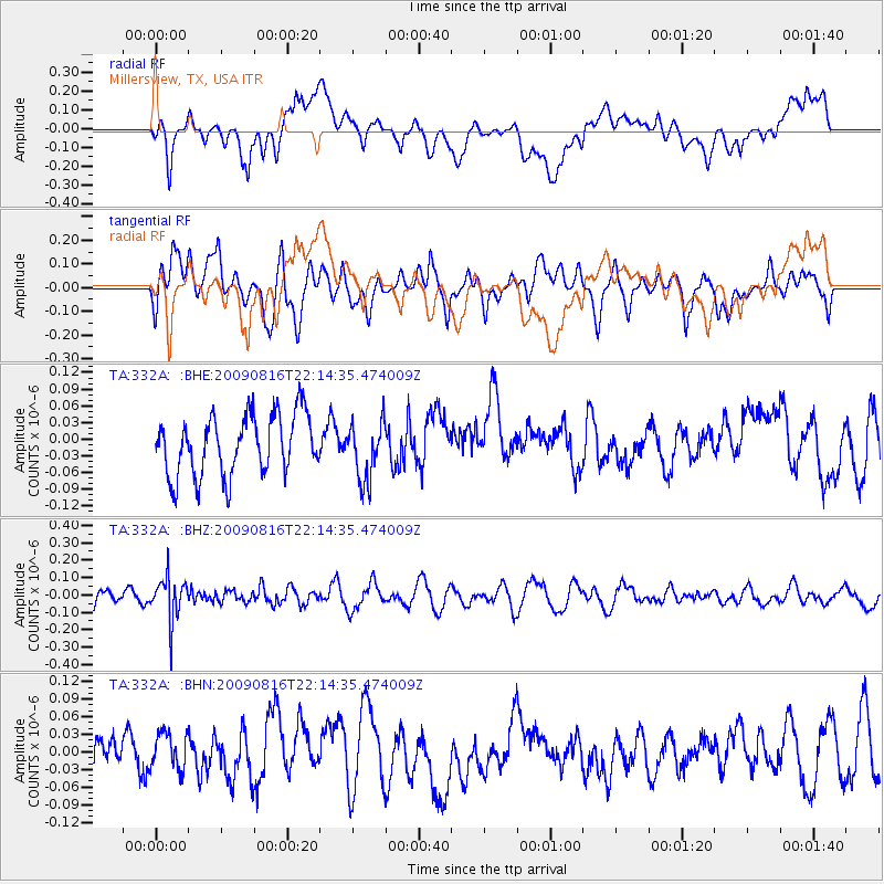
332A Millersview, TX, USA - Earthquake Result Viewer
*The percent match for this event was below the threshold and hence no stack was calculated.
| Earthquake location: |
Fiji Islands Region |
| Earthquake latitude/longitude: |
-17.9/-179.4 |
| Earthquake time(UTC): |
2009/08/16 (228) 22:03:09 GMT |
| Earthquake Depth: |
626 km |
| Earthquake Magnitude: |
5.5 MW, 4.9 MB |
| Earthquake Catalog/Contributor: |
WHDF/NEIC |
|
| Network: |
TA USArray Transportable Network (new EarthScope stations) |
| Station: |
332A Millersview, TX, USA |
| Lat/Lon: |
31.38 N/99.74 W |
| Elevation: |
513 m |
|
| Distance: |
90.7 deg |
| Az: |
57.291 deg |
| Baz: |
249.489 deg |
| Ray Param: |
$rayparam |
*The percent match for this event was below the threshold and hence was not used in the summary stack. |
|
| Radial Match: |
48.511646 % |
| Radial Bump: |
400 |
| Transverse Match: |
64.75918 % |
| Transverse Bump: |
400 |
| SOD ConfigId: |
2622 |
| Insert Time: |
2010-03-05 23:47:28.773 +0000 |
| GWidth: |
2.5 |
| Max Bumps: |
400 |
| Tol: |
0.001 |
|
Signal To Noise
| Channel | StoN | STA | LTA |
| TA:332A: :BHZ:20090816T22:14:35.474009Z | 2.448782 | 1.2261611E-7 | 5.0072284E-8 |
| TA:332A: :BHN:20090816T22:14:35.474009Z | 0.7422008 | 3.475772E-8 | 4.6830614E-8 |
| TA:332A: :BHE:20090816T22:14:35.474009Z | 0.98166925 | 5.3041784E-8 | 5.4032235E-8 |
| Arrivals |
| Ps | |
| PpPs | |
| PsPs/PpSs | |


