You are here: Home > Network List > TA - USArray Transportable Network (new EarthScope stations) Stations List
> Station 332A Millersview, TX, USA > Earthquake Result Viewer
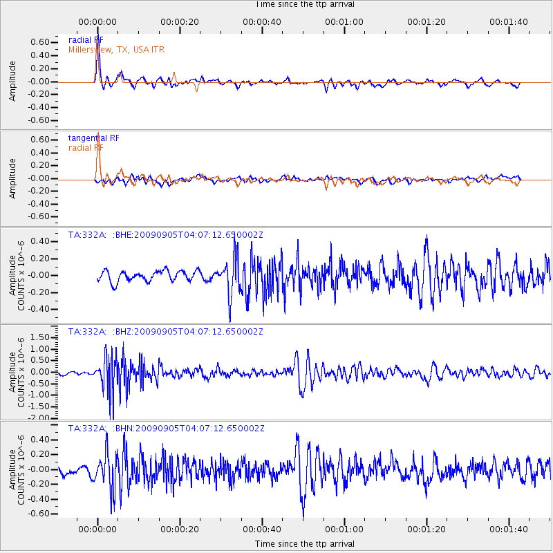
332A Millersview, TX, USA - Earthquake Result Viewer
*The percent match for this event was below the threshold and hence no stack was calculated.
| Earthquake location: |
Southern Peru |
| Earthquake latitude/longitude: |
-15.1/-70.2 |
| Earthquake time(UTC): |
2009/09/05 (248) 03:58:39 GMT |
| Earthquake Depth: |
210 km |
| Earthquake Magnitude: |
5.8 MW, 5.2 MB, 5.8 MW |
| Earthquake Catalog/Contributor: |
WHDF/NEIC |
|
| Network: |
TA USArray Transportable Network (new EarthScope stations) |
| Station: |
332A Millersview, TX, USA |
| Lat/Lon: |
31.38 N/99.74 W |
| Elevation: |
513 m |
|
| Distance: |
54.2 deg |
| Az: |
328.734 deg |
| Baz: |
144.119 deg |
| Ray Param: |
$rayparam |
*The percent match for this event was below the threshold and hence was not used in the summary stack. |
|
| Radial Match: |
78.95034 % |
| Radial Bump: |
313 |
| Transverse Match: |
54.744083 % |
| Transverse Bump: |
400 |
| SOD ConfigId: |
2622 |
| Insert Time: |
2010-03-05 23:47:33.542 +0000 |
| GWidth: |
2.5 |
| Max Bumps: |
400 |
| Tol: |
0.001 |
|
Signal To Noise
| Channel | StoN | STA | LTA |
| TA:332A: :BHZ:20090905T04:07:12.650002Z | 12.867209 | 7.462922E-7 | 5.7999536E-8 |
| TA:332A: :BHN:20090905T04:07:12.650002Z | 5.5446887 | 2.4768985E-7 | 4.4671552E-8 |
| TA:332A: :BHE:20090905T04:07:12.650002Z | 3.5815187 | 2.216017E-7 | 6.187367E-8 |
| Arrivals |
| Ps | |
| PpPs | |
| PsPs/PpSs | |


