You are here: Home > Network List > TA - USArray Transportable Network (new EarthScope stations) Stations List
> Station 332A Millersview, TX, USA > Earthquake Result Viewer
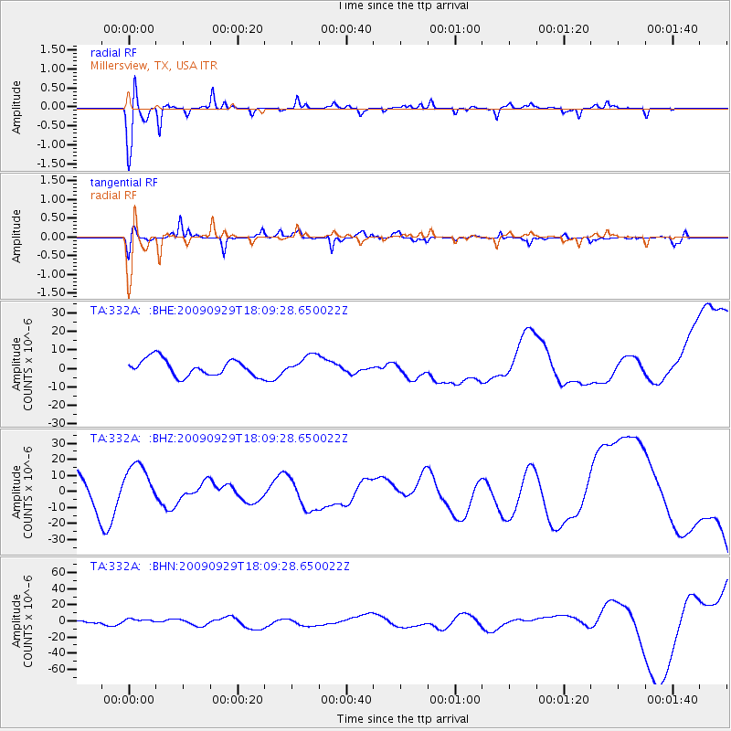
332A Millersview, TX, USA - Earthquake Result Viewer
*The percent match for this event was below the threshold and hence no stack was calculated.
| Earthquake location: |
Tonga Islands |
| Earthquake latitude/longitude: |
-15.8/-173.1 |
| Earthquake time(UTC): |
2009/09/29 (272) 17:57:26 GMT |
| Earthquake Depth: |
10 km |
| Earthquake Magnitude: |
5.6 MB |
| Earthquake Catalog/Contributor: |
WHDF/NEIC |
|
| Network: |
TA USArray Transportable Network (new EarthScope stations) |
| Station: |
332A Millersview, TX, USA |
| Lat/Lon: |
31.38 N/99.74 W |
| Elevation: |
513 m |
|
| Distance: |
84.5 deg |
| Az: |
55.413 deg |
| Baz: |
247.913 deg |
| Ray Param: |
$rayparam |
*The percent match for this event was below the threshold and hence was not used in the summary stack. |
|
| Radial Match: |
82.380135 % |
| Radial Bump: |
323 |
| Transverse Match: |
66.520775 % |
| Transverse Bump: |
400 |
| SOD ConfigId: |
2622 |
| Insert Time: |
2010-03-05 23:47:35.862 +0000 |
| GWidth: |
2.5 |
| Max Bumps: |
400 |
| Tol: |
0.001 |
|
Signal To Noise
| Channel | StoN | STA | LTA |
| TA:332A: :BHZ:20090929T18:09:28.650022Z | 1.7213271 | 1.4034918E-5 | 8.153545E-6 |
| TA:332A: :BHN:20090929T18:09:28.650022Z | 1.1442755 | 3.0455271E-6 | 2.661533E-6 |
| TA:332A: :BHE:20090929T18:09:28.650022Z | 1.1712239 | 5.2714054E-6 | 4.500767E-6 |
| Arrivals |
| Ps | |
| PpPs | |
| PsPs/PpSs | |


