You are here: Home > Network List > TA - USArray Transportable Network (new EarthScope stations) Stations List
> Station 332A Millersview, TX, USA > Earthquake Result Viewer
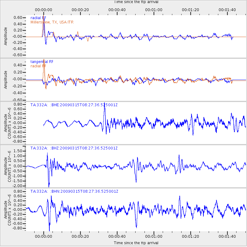
332A Millersview, TX, USA - Earthquake Result Viewer
*The percent match for this event was below the threshold and hence no stack was calculated.
| Earthquake location: |
Central Peru |
| Earthquake latitude/longitude: |
-14.5/-70.4 |
| Earthquake time(UTC): |
2009/03/15 (074) 08:19:05 GMT |
| Earthquake Depth: |
190 km |
| Earthquake Magnitude: |
5.7 MW, 5.1 MB, 5.6 MW |
| Earthquake Catalog/Contributor: |
WHDF/NEIC |
|
| Network: |
TA USArray Transportable Network (new EarthScope stations) |
| Station: |
332A Millersview, TX, USA |
| Lat/Lon: |
31.38 N/99.74 W |
| Elevation: |
513 m |
|
| Distance: |
53.6 deg |
| Az: |
328.582 deg |
| Baz: |
143.81 deg |
| Ray Param: |
$rayparam |
*The percent match for this event was below the threshold and hence was not used in the summary stack. |
|
| Radial Match: |
74.14299 % |
| Radial Bump: |
400 |
| Transverse Match: |
60.91567 % |
| Transverse Bump: |
400 |
| SOD ConfigId: |
2658 |
| Insert Time: |
2010-03-05 23:47:58.604 +0000 |
| GWidth: |
2.5 |
| Max Bumps: |
400 |
| Tol: |
0.001 |
|
Signal To Noise
| Channel | StoN | STA | LTA |
| TA:332A: :BHZ:20090315T08:27:36.525001Z | 7.8333383 | 7.0492706E-7 | 8.999063E-8 |
| TA:332A: :BHN:20090315T08:27:36.525001Z | 4.243878 | 3.355977E-7 | 7.907807E-8 |
| TA:332A: :BHE:20090315T08:27:36.525001Z | 3.4225423 | 2.9088332E-7 | 8.4990425E-8 |
| Arrivals |
| Ps | |
| PpPs | |
| PsPs/PpSs | |


