You are here: Home > Network List > TA - USArray Transportable Network (new EarthScope stations) Stations List
> Station 332A Millersview, TX, USA > Earthquake Result Viewer
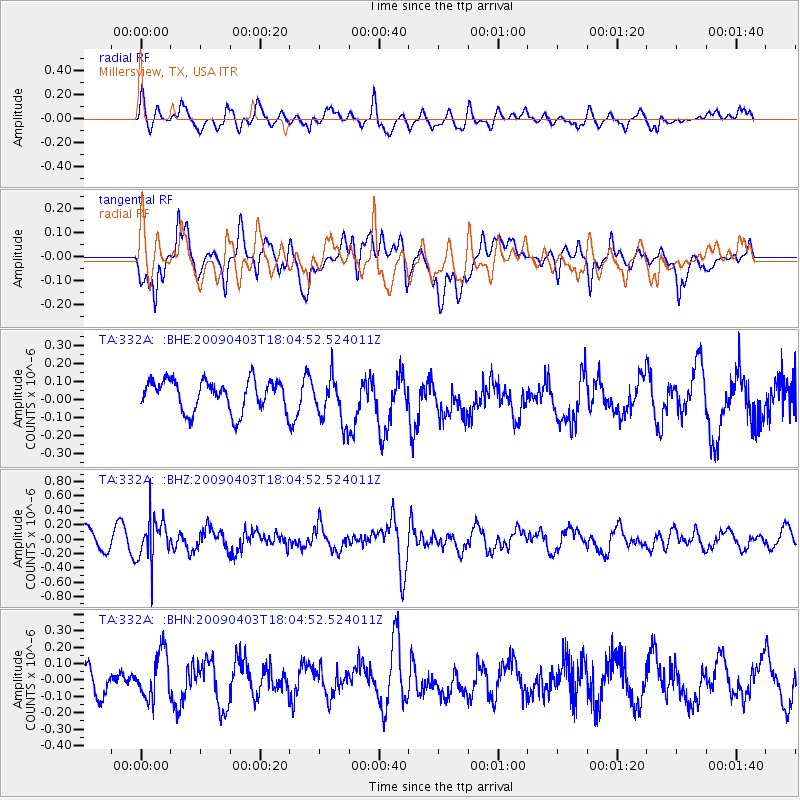
332A Millersview, TX, USA - Earthquake Result Viewer
*The percent match for this event was below the threshold and hence no stack was calculated.
| Earthquake location: |
Catamarca Province, Argentina |
| Earthquake latitude/longitude: |
-27.8/-66.6 |
| Earthquake time(UTC): |
2009/04/03 (093) 17:54:50 GMT |
| Earthquake Depth: |
174 km |
| Earthquake Magnitude: |
5.7 MW, 5.3 MB, 5.7 MW |
| Earthquake Catalog/Contributor: |
WHDF/NEIC |
|
| Network: |
TA USArray Transportable Network (new EarthScope stations) |
| Station: |
332A Millersview, TX, USA |
| Lat/Lon: |
31.38 N/99.74 W |
| Elevation: |
513 m |
|
| Distance: |
66.8 deg |
| Az: |
329.424 deg |
| Baz: |
148.218 deg |
| Ray Param: |
$rayparam |
*The percent match for this event was below the threshold and hence was not used in the summary stack. |
|
| Radial Match: |
55.878815 % |
| Radial Bump: |
400 |
| Transverse Match: |
71.87153 % |
| Transverse Bump: |
400 |
| SOD ConfigId: |
2658 |
| Insert Time: |
2010-03-05 23:48:03.361 +0000 |
| GWidth: |
2.5 |
| Max Bumps: |
400 |
| Tol: |
0.001 |
|
Signal To Noise
| Channel | StoN | STA | LTA |
| TA:332A: :BHZ:20090403T18:04:52.524011Z | 1.9097337 | 2.968308E-7 | 1.5543047E-7 |
| TA:332A: :BHN:20090403T18:04:52.524011Z | 1.3772776 | 1.447762E-7 | 1.0511765E-7 |
| TA:332A: :BHE:20090403T18:04:52.524011Z | 1.5056224 | 1.300546E-7 | 8.6379295E-8 |
| Arrivals |
| Ps | |
| PpPs | |
| PsPs/PpSs | |


