You are here: Home > Network List > CI - Caltech Regional Seismic Network Stations List
> Station MPM Manuel Prospect Mine, California, USA > Earthquake Result Viewer
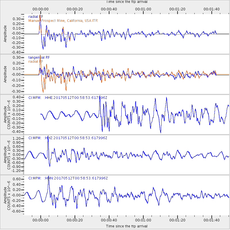
MPM Manuel Prospect Mine, California, USA - Earthquake Result Viewer
*The percent match for this event was below the threshold and hence no stack was calculated.
| Earthquake location: |
Kermadec Islands Region |
| Earthquake latitude/longitude: |
-27.5/-176.9 |
| Earthquake time(UTC): |
2017/05/12 (132) 00:46:52 GMT |
| Earthquake Depth: |
10 km |
| Earthquake Magnitude: |
5.8 mb |
| Earthquake Catalog/Contributor: |
NEIC PDE/us |
|
| Network: |
CI Caltech Regional Seismic Network |
| Station: |
MPM Manuel Prospect Mine, California, USA |
| Lat/Lon: |
36.06 N/117.49 W |
| Elevation: |
185 m |
|
| Distance: |
84.4 deg |
| Az: |
44.478 deg |
| Baz: |
230.194 deg |
| Ray Param: |
$rayparam |
*The percent match for this event was below the threshold and hence was not used in the summary stack. |
|
| Radial Match: |
56.55239 % |
| Radial Bump: |
400 |
| Transverse Match: |
58.45242 % |
| Transverse Bump: |
400 |
| SOD ConfigId: |
11737051 |
| Insert Time: |
2019-04-27 08:41:39.976 +0000 |
| GWidth: |
2.5 |
| Max Bumps: |
400 |
| Tol: |
0.001 |
|
Signal To Noise
| Channel | StoN | STA | LTA |
| CI:MPM: :HHZ:20170512T00:58:53.617996Z | 2.7090797 | 3.9827304E-7 | 1.4701415E-7 |
| CI:MPM: :HHN:20170512T00:58:53.617996Z | 3.8209903 | 2.5957488E-7 | 6.7933925E-8 |
| CI:MPM: :HHE:20170512T00:58:53.617996Z | 2.044615 | 1.2655929E-7 | 6.189884E-8 |
| Arrivals |
| Ps | |
| PpPs | |
| PsPs/PpSs | |


