232A Coleman, TX, USA - Earthquake Result Viewer
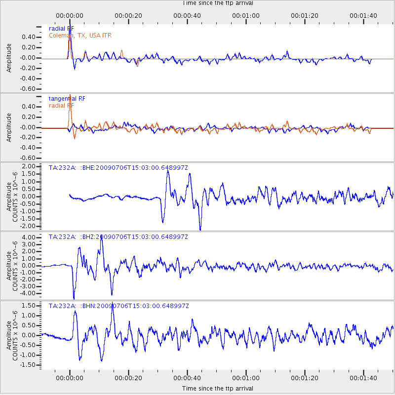
Earthquake location: Rat Islands, Aleutian Islands
Earthquake latitude/longitude: 50.4/177.0
Earthquake time(UTC): 2009/07/06 (187) 14:53:12 GMT
Earthquake Depth: 22 km
Earthquake Magnitude: 6.0 MB, 5.8 MS, 6.1 MW, 6.0 MW
Earthquake Catalog/Contributor: WHDF/NEIC
Network: TA USArray Transportable Network (new EarthScope stations)
Station: 232A Coleman, TX, USA
Lat/Lon: 31.89 N/99.65 W
Elevation: 621 m
Distance: 62.2 deg
Az: 72.861 deg
Baz: 314.08 deg
Ray Param: 0.060384836
Estimated Moho Depth: 33.75 km
Estimated Crust Vp/Vs: 2.02
Assumed Crust Vp: 6.498 km/s
Estimated Crust Vs: 3.221 km/s
Estimated Crust Poisson's Ratio: 0.34
Radial Match: 94.41023 %
Radial Bump: 400
Transverse Match: 81.68709 %
Transverse Bump: 400
SOD ConfigId: 2648
Insert Time: 2010-03-05 23:48:31.529 +0000
GWidth: 2.5
Max Bumps: 400
Tol: 0.001

Signal To Noise

ChannelStoNSTALTA
TA:232A: :BHZ:20090706T15:03:00.648997Z11.2339171.920452E-61.7095122E-7
TA:232A: :BHN:20090706T15:03:00.648997Z7.1287467.1180153E-79.984947E-8
TA:232A: :BHE:20090706T15:03:00.648997Z9.0275579.384646E-71.03955536E-7
Arrivals
Ps5.5 SECOND
PpPs15 SECOND
PsPs/PpSs21 SECOND