You are here: Home > Network List > TA - USArray Transportable Network (new EarthScope stations) Stations List
> Station 232A Coleman, TX, USA > Earthquake Result Viewer
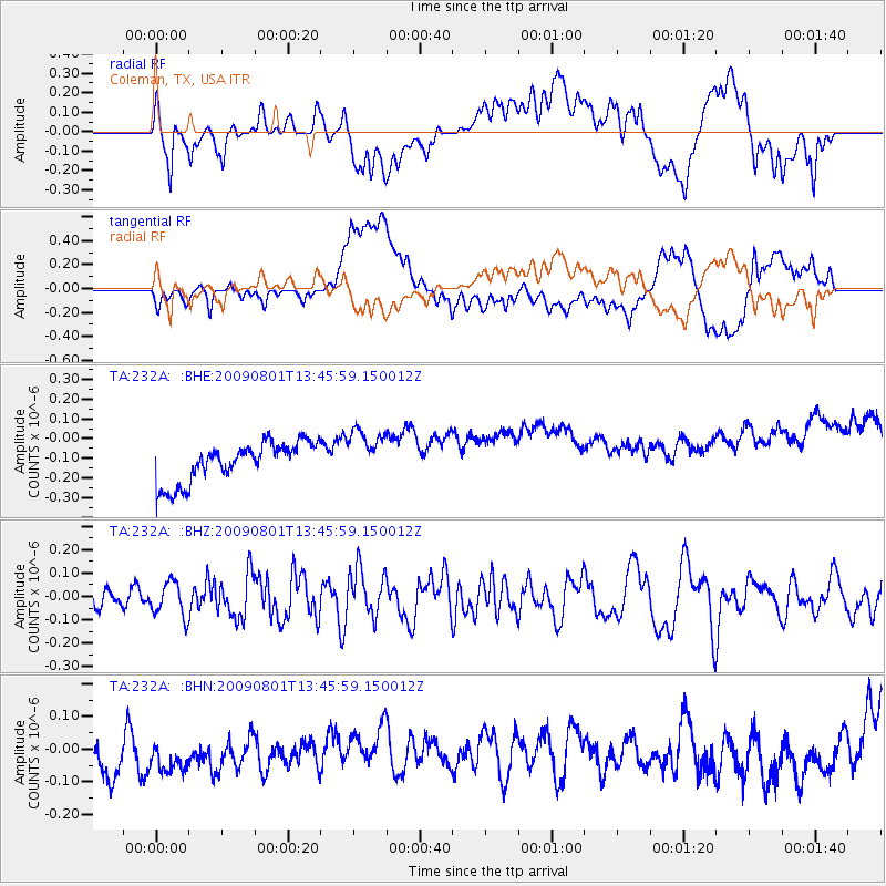
232A Coleman, TX, USA - Earthquake Result Viewer
*The percent match for this event was below the threshold and hence no stack was calculated.
| Earthquake location: |
Southern East Pacific Rise |
| Earthquake latitude/longitude: |
-56.2/-124.3 |
| Earthquake time(UTC): |
2009/08/01 (213) 13:33:29 GMT |
| Earthquake Depth: |
10 km |
| Earthquake Magnitude: |
6.1 MW, 5.4 MS, 5.2 MB, 6.0 MW |
| Earthquake Catalog/Contributor: |
WHDF/NEIC |
|
| Network: |
TA USArray Transportable Network (new EarthScope stations) |
| Station: |
232A Coleman, TX, USA |
| Lat/Lon: |
31.89 N/99.65 W |
| Elevation: |
621 m |
|
| Distance: |
90.3 deg |
| Az: |
20.78 deg |
| Baz: |
193.467 deg |
| Ray Param: |
$rayparam |
*The percent match for this event was below the threshold and hence was not used in the summary stack. |
|
| Radial Match: |
28.7407 % |
| Radial Bump: |
400 |
| Transverse Match: |
18.786407 % |
| Transverse Bump: |
400 |
| SOD ConfigId: |
2622 |
| Insert Time: |
2010-03-05 23:48:48.723 +0000 |
| GWidth: |
2.5 |
| Max Bumps: |
400 |
| Tol: |
0.001 |
|
Signal To Noise
| Channel | StoN | STA | LTA |
| TA:232A: :BHZ:20090801T13:45:59.150012Z | 1.9151773 | 7.346438E-8 | 3.8359047E-8 |
| TA:232A: :BHN:20090801T13:45:59.150012Z | 1.0249431 | 1.6731377E-7 | 1.63242E-7 |
| TA:232A: :BHE:20090801T13:45:59.150012Z | 1.2625234 | 1.2664164E-7 | 1.0030835E-7 |
| Arrivals |
| Ps | |
| PpPs | |
| PsPs/PpSs | |


