You are here: Home > Network List > UW - Pacific Northwest Regional Seismic Network Stations List
> Station LEBA Lebam, WA, USA > Earthquake Result Viewer
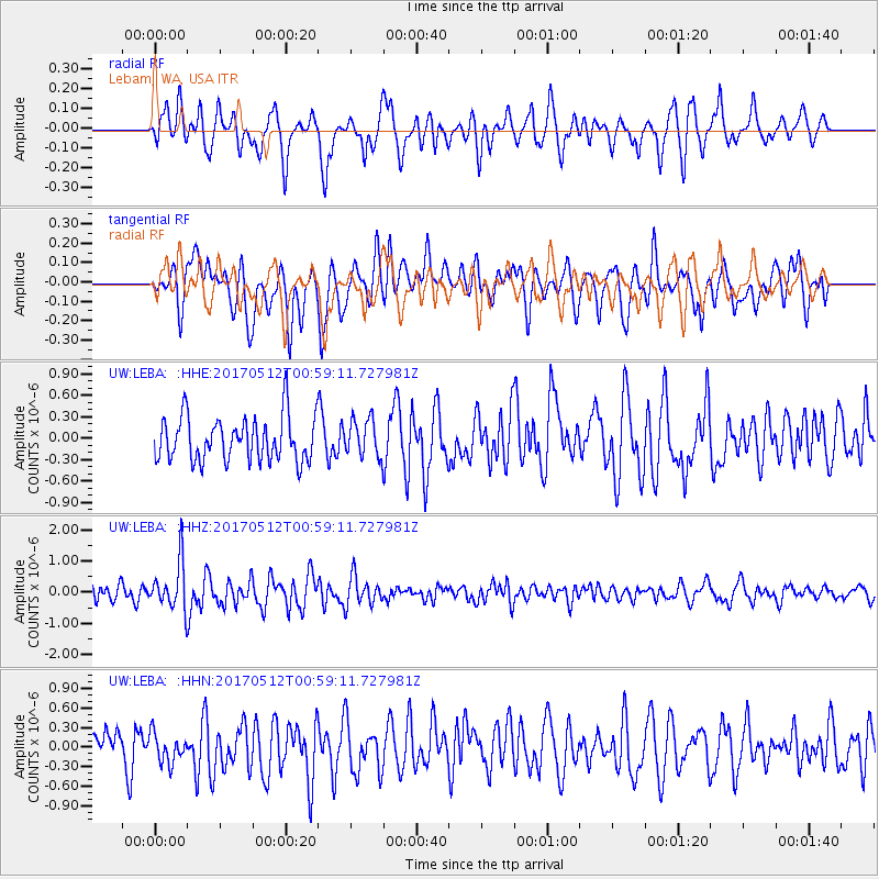
LEBA Lebam, WA, USA - Earthquake Result Viewer
*The percent match for this event was below the threshold and hence no stack was calculated.
| Earthquake location: |
Kermadec Islands Region |
| Earthquake latitude/longitude: |
-27.5/-176.9 |
| Earthquake time(UTC): |
2017/05/12 (132) 00:46:52 GMT |
| Earthquake Depth: |
10 km |
| Earthquake Magnitude: |
5.8 mb |
| Earthquake Catalog/Contributor: |
NEIC PDE/us |
|
| Network: |
UW Pacific Northwest Regional Seismic Network |
| Station: |
LEBA Lebam, WA, USA |
| Lat/Lon: |
46.55 N/123.56 W |
| Elevation: |
73 m |
|
| Distance: |
88.0 deg |
| Az: |
33.623 deg |
| Baz: |
225.461 deg |
| Ray Param: |
$rayparam |
*The percent match for this event was below the threshold and hence was not used in the summary stack. |
|
| Radial Match: |
58.208866 % |
| Radial Bump: |
400 |
| Transverse Match: |
59.223484 % |
| Transverse Bump: |
400 |
| SOD ConfigId: |
11737051 |
| Insert Time: |
2019-04-27 08:46:32.299 +0000 |
| GWidth: |
2.5 |
| Max Bumps: |
400 |
| Tol: |
0.001 |
|
Signal To Noise
| Channel | StoN | STA | LTA |
| UW:LEBA: :HHZ:20170512T00:59:11.727981Z | 3.3640566 | 7.67869E-7 | 2.2825687E-7 |
| UW:LEBA: :HHN:20170512T00:59:11.727981Z | 0.6647419 | 2.2858553E-7 | 3.4387114E-7 |
| UW:LEBA: :HHE:20170512T00:59:11.727981Z | 0.8371933 | 2.582102E-7 | 3.0842367E-7 |
| Arrivals |
| Ps | |
| PpPs | |
| PsPs/PpSs | |


