You are here: Home > Network List > UW - Pacific Northwest Regional Seismic Network Stations List
> Station UMAT Pilot Rock, OR, USA > Earthquake Result Viewer
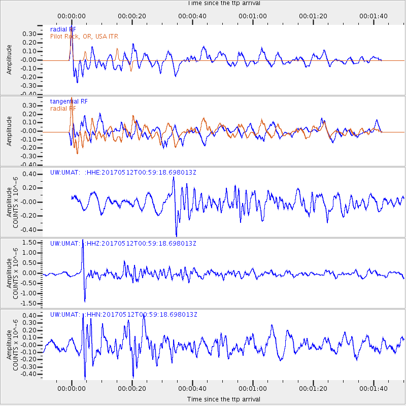
UMAT Pilot Rock, OR, USA - Earthquake Result Viewer
*The percent match for this event was below the threshold and hence no stack was calculated.
| Earthquake location: |
Kermadec Islands Region |
| Earthquake latitude/longitude: |
-27.5/-176.9 |
| Earthquake time(UTC): |
2017/05/12 (132) 00:46:52 GMT |
| Earthquake Depth: |
10 km |
| Earthquake Magnitude: |
5.8 mb |
| Earthquake Catalog/Contributor: |
NEIC PDE/us |
|
| Network: |
UW Pacific Northwest Regional Seismic Network |
| Station: |
UMAT Pilot Rock, OR, USA |
| Lat/Lon: |
45.29 N/118.96 W |
| Elevation: |
1318 m |
|
| Distance: |
89.5 deg |
| Az: |
36.729 deg |
| Baz: |
228.825 deg |
| Ray Param: |
$rayparam |
*The percent match for this event was below the threshold and hence was not used in the summary stack. |
|
| Radial Match: |
68.31946 % |
| Radial Bump: |
400 |
| Transverse Match: |
65.14168 % |
| Transverse Bump: |
400 |
| SOD ConfigId: |
11737051 |
| Insert Time: |
2019-04-27 08:46:40.101 +0000 |
| GWidth: |
2.5 |
| Max Bumps: |
400 |
| Tol: |
0.001 |
|
Signal To Noise
| Channel | StoN | STA | LTA |
| UW:UMAT: :HHZ:20170512T00:59:18.698013Z | 10.946394 | 5.744394E-7 | 5.24775E-8 |
| UW:UMAT: :HHN:20170512T00:59:18.698013Z | 2.8322601 | 1.7240095E-7 | 6.087045E-8 |
| UW:UMAT: :HHE:20170512T00:59:18.698013Z | 2.6328502 | 1.9028398E-7 | 7.2273004E-8 |
| Arrivals |
| Ps | |
| PpPs | |
| PsPs/PpSs | |


