
Z32A Haskell, TX, USA - Earthquake Result Viewer
| ||||||||||||||||||
| ||||||||||||||||||
| ||||||||||||||||||
|
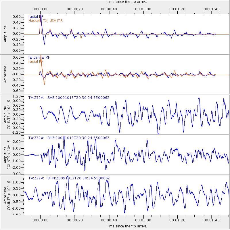
Signal To Noise
| Channel | StoN | STA | LTA |
| TA:Z32A: :BHZ:20091013T20:30:24.550006Z | 2.1137426 | 3.9497593E-7 | 1.8686094E-7 |
| TA:Z32A: :BHN:20091013T20:30:24.550006Z | 0.97705686 | 2.4726864E-7 | 2.5307497E-7 |
| TA:Z32A: :BHE:20091013T20:30:24.550006Z | 0.45765463 | 1.3128444E-7 | 2.8686358E-7 |
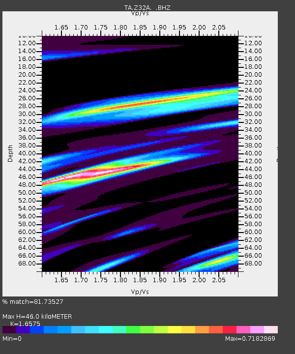
| Arrivals | |
| Ps | 5.0 SECOND |
| PpPs | 18 SECOND |
| PsPs/PpSs | 23 SECOND |

