You are here: Home > Network List > TA - USArray Transportable Network (new EarthScope stations) Stations List
> Station Z32A Haskell, TX, USA > Earthquake Result Viewer
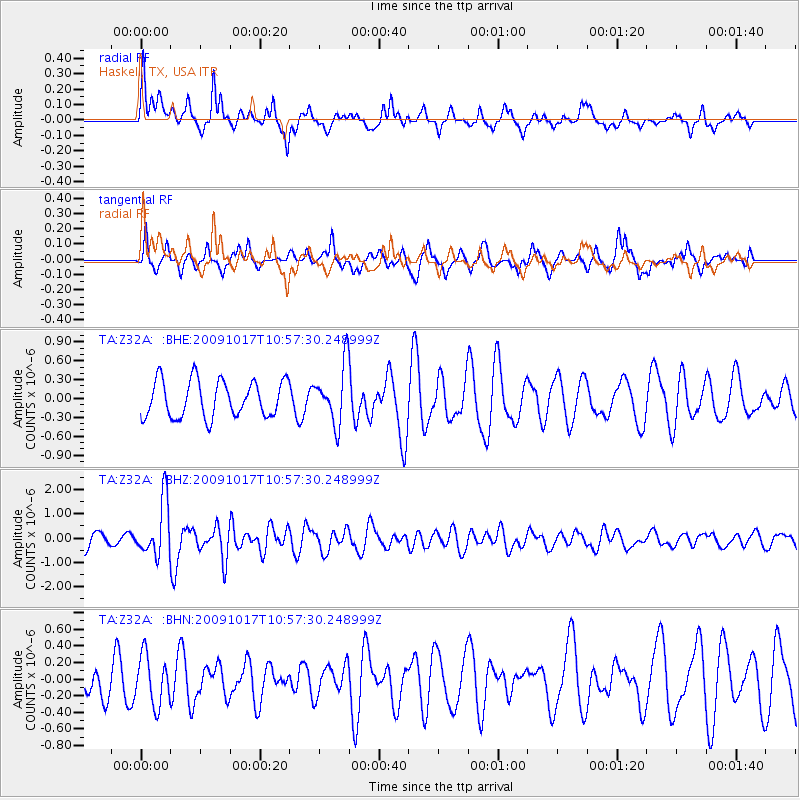
Z32A Haskell, TX, USA - Earthquake Result Viewer
*The percent match for this event was below the threshold and hence no stack was calculated.
| Earthquake location: |
Samoa Islands Region |
| Earthquake latitude/longitude: |
-16.4/-172.0 |
| Earthquake time(UTC): |
2009/10/17 (290) 10:45:26 GMT |
| Earthquake Depth: |
10 km |
| Earthquake Magnitude: |
5.7 MB, 5.3 MS, 5.7 MW, 5.7 MW |
| Earthquake Catalog/Contributor: |
WHDF/NEIC |
|
| Network: |
TA USArray Transportable Network (new EarthScope stations) |
| Station: |
Z32A Haskell, TX, USA |
| Lat/Lon: |
33.31 N/99.48 W |
| Elevation: |
427 m |
|
| Distance: |
84.9 deg |
| Az: |
53.308 deg |
| Baz: |
246.812 deg |
| Ray Param: |
$rayparam |
*The percent match for this event was below the threshold and hence was not used in the summary stack. |
|
| Radial Match: |
72.17044 % |
| Radial Bump: |
400 |
| Transverse Match: |
65.74822 % |
| Transverse Bump: |
390 |
| SOD ConfigId: |
2622 |
| Insert Time: |
2010-03-05 23:50:38.079 +0000 |
| GWidth: |
2.5 |
| Max Bumps: |
400 |
| Tol: |
0.001 |
|
Signal To Noise
| Channel | StoN | STA | LTA |
| TA:Z32A: :BHZ:20091017T10:57:30.248999Z | 3.6158116 | 1.131881E-6 | 3.130365E-7 |
| TA:Z32A: :BHN:20091017T10:57:30.248999Z | 1.4574751 | 2.9557802E-7 | 2.0280142E-7 |
| TA:Z32A: :BHE:20091017T10:57:30.248999Z | 1.6085631 | 4.6599126E-7 | 2.8969413E-7 |
| Arrivals |
| Ps | |
| PpPs | |
| PsPs/PpSs | |


