You are here: Home > Network List > TA - USArray Transportable Network (new EarthScope stations) Stations List
> Station Y30A Stafford Cattle Company, Roaring Springs, TX, USA > Earthquake Result Viewer
Y30A Stafford Cattle Company, Roaring Springs, TX, USA - Earthquake Result Viewer

| Earthquake location: |
Kuril Islands |
| Earthquake latitude/longitude: |
46.0/151.4 |
| Earthquake time(UTC): |
2009/04/18 (108) 19:17:58 GMT |
| Earthquake Depth: |
35 km |
| Earthquake Magnitude: |
6.3 MB, 6.3 MS, 6.6 MW, 6.4 MW |
| Earthquake Catalog/Contributor: |
WHDF/NEIC |
|
| Network: |
TA USArray Transportable Network (new EarthScope stations) |
| Station: |
Y30A Stafford Cattle Company, Roaring Springs, TX, USA |
| Lat/Lon: |
33.88 N/100.90 W |
| Elevation: |
812 m |
|
| Distance: |
77.2 deg |
| Az: |
54.386 deg |
| Baz: |
317.082 deg |
| Ray Param: |
0.05044627 |
| Estimated Moho Depth: |
26.5 km |
| Estimated Crust Vp/Vs: |
1.81 |
| Assumed Crust Vp: |
6.426 km/s |
| Estimated Crust Vs: |
3.545 km/s |
| Estimated Crust Poisson's Ratio: |
0.28 |
|
| Radial Match: |
93.04626 % |
| Radial Bump: |
400 |
| Transverse Match: |
86.933495 % |
| Transverse Bump: |
400 |
| SOD ConfigId: |
2658 |
| Insert Time: |
2010-03-05 23:51:26.942 +0000 |
| GWidth: |
2.5 |
| Max Bumps: |
400 |
| Tol: |
0.001 |
|
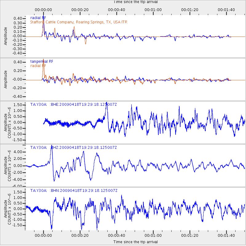
Signal To Noise
| Channel | StoN | STA | LTA |
| TA:Y30A: :BHZ:20090418T19:29:18.125007Z | 23.879023 | 2.3141977E-6 | 9.691341E-8 |
| TA:Y30A: :BHN:20090418T19:29:18.125007Z | 4.2835627 | 7.011194E-7 | 1.636767E-7 |
| TA:Y30A: :BHE:20090418T19:29:18.125007Z | 5.058219 | 6.9506285E-7 | 1.3741257E-7 |
| Arrivals |
| Ps | 3.5 SECOND |
| PpPs | 11 SECOND |
| PsPs/PpSs | 15 SECOND |


