You are here: Home > Network List > TA - USArray Transportable Network (new EarthScope stations) Stations List
> Station R33M Jennings River, BC, CAN > Earthquake Result Viewer
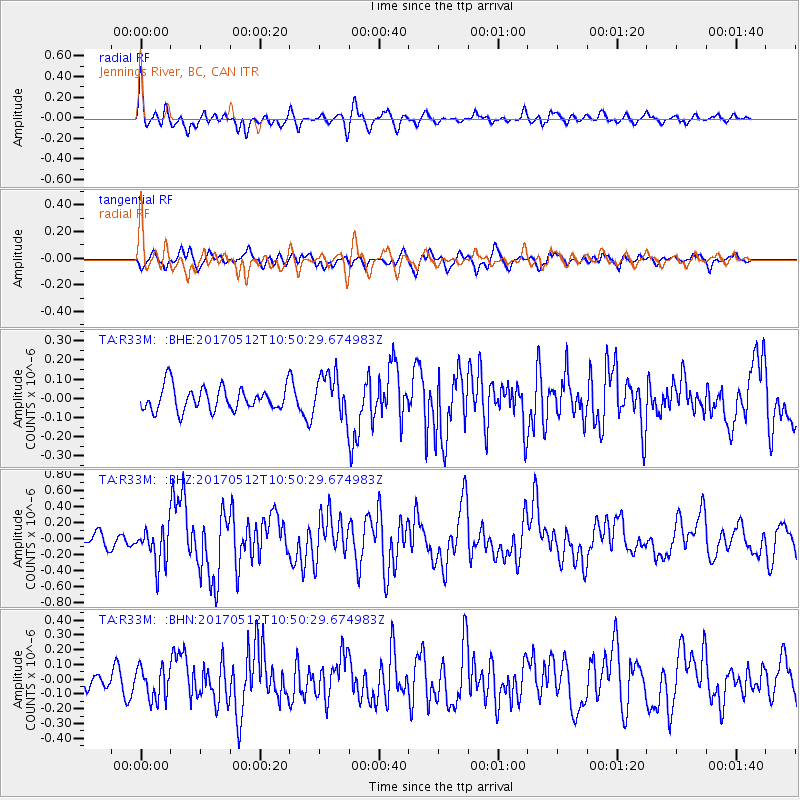
R33M Jennings River, BC, CAN - Earthquake Result Viewer
*The percent match for this event was below the threshold and hence no stack was calculated.
| Earthquake location: |
Off Coast Of Central America |
| Earthquake latitude/longitude: |
12.9/-90.1 |
| Earthquake time(UTC): |
2017/05/12 (132) 10:41:26 GMT |
| Earthquake Depth: |
10 km |
| Earthquake Magnitude: |
6.2 Mww |
| Earthquake Catalog/Contributor: |
NEIC PDE/us |
|
| Network: |
TA USArray Transportable Network (new EarthScope stations) |
| Station: |
R33M Jennings River, BC, CAN |
| Lat/Lon: |
59.39 N/130.97 W |
| Elevation: |
1437 m |
|
| Distance: |
55.4 deg |
| Az: |
335.98 deg |
| Baz: |
129.132 deg |
| Ray Param: |
$rayparam |
*The percent match for this event was below the threshold and hence was not used in the summary stack. |
|
| Radial Match: |
74.04441 % |
| Radial Bump: |
400 |
| Transverse Match: |
63.493008 % |
| Transverse Bump: |
400 |
| SOD ConfigId: |
11737051 |
| Insert Time: |
2019-04-27 08:58:54.066 +0000 |
| GWidth: |
2.5 |
| Max Bumps: |
400 |
| Tol: |
0.001 |
|
Signal To Noise
| Channel | StoN | STA | LTA |
| TA:R33M: :BHZ:20170512T10:50:29.674983Z | 2.7288516 | 2.3655126E-7 | 8.668528E-8 |
| TA:R33M: :BHN:20170512T10:50:29.674983Z | 1.4194593 | 1.0724436E-7 | 7.555296E-8 |
| TA:R33M: :BHE:20170512T10:50:29.674983Z | 1.7880943 | 1.1080852E-7 | 6.197018E-8 |
| Arrivals |
| Ps | |
| PpPs | |
| PsPs/PpSs | |


