You are here: Home > Network List > UW - Pacific Northwest Regional Seismic Network Stations List
> Station MRBL Marblemount, WA, USA > Earthquake Result Viewer
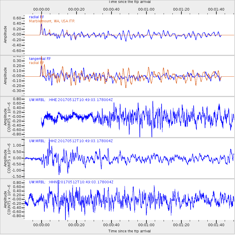
MRBL Marblemount, WA, USA - Earthquake Result Viewer
*The percent match for this event was below the threshold and hence no stack was calculated.
| Earthquake location: |
Off Coast Of Central America |
| Earthquake latitude/longitude: |
12.9/-90.1 |
| Earthquake time(UTC): |
2017/05/12 (132) 10:41:26 GMT |
| Earthquake Depth: |
10 km |
| Earthquake Magnitude: |
6.2 Mww |
| Earthquake Catalog/Contributor: |
NEIC PDE/us |
|
| Network: |
UW Pacific Northwest Regional Seismic Network |
| Station: |
MRBL Marblemount, WA, USA |
| Lat/Lon: |
48.52 N/121.48 W |
| Elevation: |
75 m |
|
| Distance: |
44.0 deg |
| Az: |
330.077 deg |
| Baz: |
132.985 deg |
| Ray Param: |
$rayparam |
*The percent match for this event was below the threshold and hence was not used in the summary stack. |
|
| Radial Match: |
64.517944 % |
| Radial Bump: |
400 |
| Transverse Match: |
61.31467 % |
| Transverse Bump: |
400 |
| SOD ConfigId: |
11737051 |
| Insert Time: |
2019-04-27 08:59:24.849 +0000 |
| GWidth: |
2.5 |
| Max Bumps: |
400 |
| Tol: |
0.001 |
|
Signal To Noise
| Channel | StoN | STA | LTA |
| UW:MRBL: :HHZ:20170512T10:49:03.178004Z | 4.530011 | 4.530444E-7 | 1.0000956E-7 |
| UW:MRBL: :HHN:20170512T10:49:03.178004Z | 1.8256196 | 2.3828424E-7 | 1.3052241E-7 |
| UW:MRBL: :HHE:20170512T10:49:03.178004Z | 1.2128274 | 1.5840288E-7 | 1.3060628E-7 |
| Arrivals |
| Ps | |
| PpPs | |
| PsPs/PpSs | |


