You are here: Home > Network List > IW - Intermountain West Stations List
> Station PLID Pearl Lake, Idaho, USA > Earthquake Result Viewer
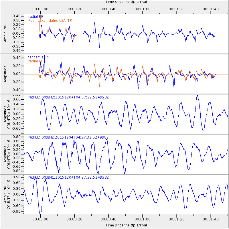
PLID Pearl Lake, Idaho, USA - Earthquake Result Viewer
*The percent match for this event was below the threshold and hence no stack was calculated.
| Earthquake location: |
Mariana Islands Region |
| Earthquake latitude/longitude: |
21.5/145.7 |
| Earthquake time(UTC): |
2015/12/04 (338) 04:25:50 GMT |
| Earthquake Depth: |
10 km |
| Earthquake Magnitude: |
5.6 MB |
| Earthquake Catalog/Contributor: |
NEIC PDE/NEIC COMCAT |
|
| Network: |
IW Intermountain West |
| Station: |
PLID Pearl Lake, Idaho, USA |
| Lat/Lon: |
45.09 N/116.00 W |
| Elevation: |
2164 m |
|
| Distance: |
80.7 deg |
| Az: |
45.267 deg |
| Baz: |
290.919 deg |
| Ray Param: |
$rayparam |
*The percent match for this event was below the threshold and hence was not used in the summary stack. |
|
| Radial Match: |
63.00068 % |
| Radial Bump: |
400 |
| Transverse Match: |
59.255733 % |
| Transverse Bump: |
351 |
| SOD ConfigId: |
1259291 |
| Insert Time: |
2015-12-18 04:32:37.714 +0000 |
| GWidth: |
2.5 |
| Max Bumps: |
400 |
| Tol: |
0.001 |
|
Signal To Noise
| Channel | StoN | STA | LTA |
| IW:PLID:00:BHZ:20151204T04:37:32.524998Z | 1.3996096 | 3.1029433E-7 | 2.2170062E-7 |
| IW:PLID:00:BH1:20151204T04:37:32.524998Z | 1.6723256 | 6.597407E-7 | 3.9450495E-7 |
| IW:PLID:00:BH2:20151204T04:37:32.524998Z | 0.61550766 | 1.9749085E-7 | 3.2085848E-7 |
| Arrivals |
| Ps | |
| PpPs | |
| PsPs/PpSs | |


