You are here: Home > Network List > TA - USArray Transportable Network (new EarthScope stations) Stations List
> Station 833A Chaparral WMA, Artesia Wells, TX, USA > Earthquake Result Viewer
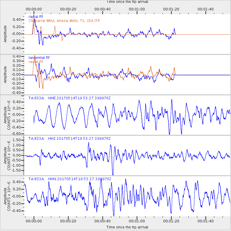
833A Chaparral WMA, Artesia Wells, TX, USA - Earthquake Result Viewer
*The percent match for this event was below the threshold and hence no stack was calculated.
| Earthquake location: |
Chile-Bolivia Border Region |
| Earthquake latitude/longitude: |
-20.9/-68.7 |
| Earthquake time(UTC): |
2017/05/14 (134) 19:44:23 GMT |
| Earthquake Depth: |
124 km |
| Earthquake Magnitude: |
5.6 Mww |
| Earthquake Catalog/Contributor: |
NEIC PDE/us |
|
| Network: |
TA USArray Transportable Network (new EarthScope stations) |
| Station: |
833A Chaparral WMA, Artesia Wells, TX, USA |
| Lat/Lon: |
28.32 N/99.39 W |
| Elevation: |
171 m |
|
| Distance: |
57.2 deg |
| Az: |
327.678 deg |
| Baz: |
145.462 deg |
| Ray Param: |
$rayparam |
*The percent match for this event was below the threshold and hence was not used in the summary stack. |
|
| Radial Match: |
54.222713 % |
| Radial Bump: |
400 |
| Transverse Match: |
65.418396 % |
| Transverse Bump: |
400 |
| SOD ConfigId: |
13570011 |
| Insert Time: |
2019-04-28 01:04:26.779 +0000 |
| GWidth: |
2.5 |
| Max Bumps: |
400 |
| Tol: |
0.001 |
|
Signal To Noise
| Channel | StoN | STA | LTA |
| TA:833A: :HHZ:20170514T19:53:27.399976Z | 1.5325946 | 3.03114E-7 | 1.9777835E-7 |
| TA:833A: :HHN:20170514T19:53:27.399976Z | 0.3269046 | 8.491154E-8 | 2.597441E-7 |
| TA:833A: :HHE:20170514T19:53:27.399976Z | 1.1632322 | 2.5713186E-7 | 2.2104946E-7 |
| Arrivals |
| Ps | |
| PpPs | |
| PsPs/PpSs | |


