You are here: Home > Network List > CI - Caltech Regional Seismic Network Stations List
> Station FUR Furnace Creek, CA, USA > Earthquake Result Viewer
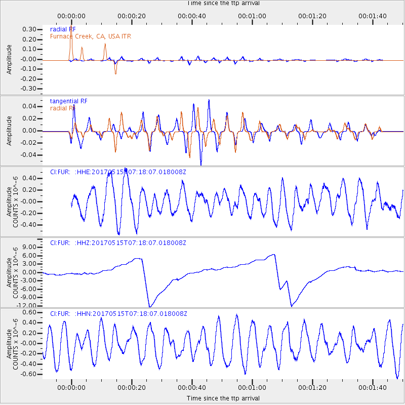
FUR Furnace Creek, CA, USA - Earthquake Result Viewer
*The percent match for this event was below the threshold and hence no stack was calculated.
| Earthquake location: |
Ryukyu Islands, Japan |
| Earthquake latitude/longitude: |
27.2/130.2 |
| Earthquake time(UTC): |
2017/05/15 (135) 07:05:36 GMT |
| Earthquake Depth: |
10 km |
| Earthquake Magnitude: |
5.5 Mww |
| Earthquake Catalog/Contributor: |
NEIC PDE/us |
|
| Network: |
CI Caltech Regional Seismic Network |
| Station: |
FUR Furnace Creek, CA, USA |
| Lat/Lon: |
36.47 N/116.86 W |
| Elevation: |
-37.0 m |
|
| Distance: |
90.6 deg |
| Az: |
47.915 deg |
| Baz: |
304.927 deg |
| Ray Param: |
$rayparam |
*The percent match for this event was below the threshold and hence was not used in the summary stack. |
|
| Radial Match: |
44.832886 % |
| Radial Bump: |
400 |
| Transverse Match: |
41.1092 % |
| Transverse Bump: |
400 |
| SOD ConfigId: |
13570011 |
| Insert Time: |
2019-04-28 01:07:39.389 +0000 |
| GWidth: |
2.5 |
| Max Bumps: |
400 |
| Tol: |
0.001 |
|
Signal To Noise
| Channel | StoN | STA | LTA |
| CI:FUR: :HHZ:20170515T07:18:07.018008Z | 1.1730459 | 1.4398871E-6 | 1.2274771E-6 |
| CI:FUR: :HHN:20170515T07:18:07.018008Z | 0.8556993 | 2.3633419E-7 | 2.7618836E-7 |
| CI:FUR: :HHE:20170515T07:18:07.018008Z | 0.5507992 | 1.6046657E-7 | 2.9133406E-7 |
| Arrivals |
| Ps | |
| PpPs | |
| PsPs/PpSs | |


