You are here: Home > Network List > CI - Caltech Regional Seismic Network Stations List
> Station LRL Laurel Mtn Radio Fac, Ridgecrest, CA, USA > Earthquake Result Viewer
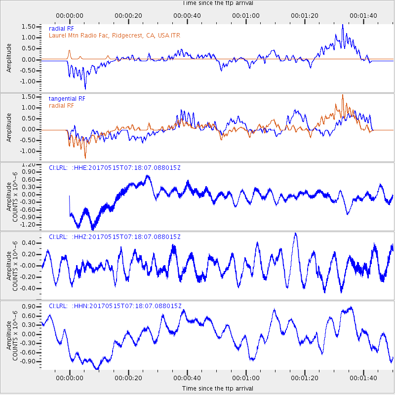
LRL Laurel Mtn Radio Fac, Ridgecrest, CA, USA - Earthquake Result Viewer
*The percent match for this event was below the threshold and hence no stack was calculated.
| Earthquake location: |
Ryukyu Islands, Japan |
| Earthquake latitude/longitude: |
27.2/130.2 |
| Earthquake time(UTC): |
2017/05/15 (135) 07:05:36 GMT |
| Earthquake Depth: |
10 km |
| Earthquake Magnitude: |
5.5 Mww |
| Earthquake Catalog/Contributor: |
NEIC PDE/us |
|
| Network: |
CI Caltech Regional Seismic Network |
| Station: |
LRL Laurel Mtn Radio Fac, Ridgecrest, CA, USA |
| Lat/Lon: |
35.48 N/117.68 W |
| Elevation: |
1340 m |
|
| Distance: |
90.6 deg |
| Az: |
49.104 deg |
| Baz: |
304.435 deg |
| Ray Param: |
$rayparam |
*The percent match for this event was below the threshold and hence was not used in the summary stack. |
|
| Radial Match: |
56.859585 % |
| Radial Bump: |
400 |
| Transverse Match: |
47.564247 % |
| Transverse Bump: |
400 |
| SOD ConfigId: |
13570011 |
| Insert Time: |
2019-04-28 01:07:44.503 +0000 |
| GWidth: |
2.5 |
| Max Bumps: |
400 |
| Tol: |
0.001 |
|
Signal To Noise
| Channel | StoN | STA | LTA |
| CI:LRL: :HHZ:20170515T07:18:07.088015Z | 1.3954176 | 1.8560475E-7 | 1.3301019E-7 |
| CI:LRL: :HHN:20170515T07:18:07.088015Z | 5.9842577 | 1.4172969E-6 | 2.3683754E-7 |
| CI:LRL: :HHE:20170515T07:18:07.088015Z | 0.8860281 | 5.098414E-7 | 5.7542354E-7 |
| Arrivals |
| Ps | |
| PpPs | |
| PsPs/PpSs | |


