You are here: Home > Network List > TA - USArray Transportable Network (new EarthScope stations) Stations List
> Station F26K Sheenjek River, AK, USA > Earthquake Result Viewer
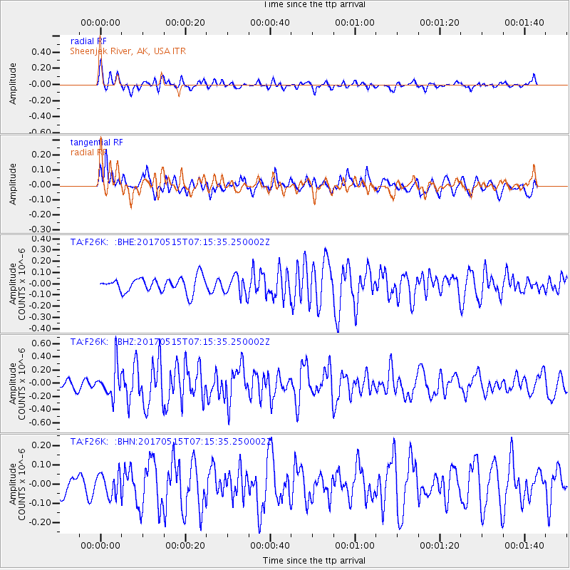
F26K Sheenjek River, AK, USA - Earthquake Result Viewer
*The percent match for this event was below the threshold and hence no stack was calculated.
| Earthquake location: |
Ryukyu Islands, Japan |
| Earthquake latitude/longitude: |
27.2/130.2 |
| Earthquake time(UTC): |
2017/05/15 (135) 07:05:36 GMT |
| Earthquake Depth: |
10 km |
| Earthquake Magnitude: |
5.5 Mww |
| Earthquake Catalog/Contributor: |
NEIC PDE/us |
|
| Network: |
TA USArray Transportable Network (new EarthScope stations) |
| Station: |
F26K Sheenjek River, AK, USA |
| Lat/Lon: |
67.69 N/144.15 W |
| Elevation: |
683 m |
|
| Distance: |
63.5 deg |
| Az: |
25.169 deg |
| Baz: |
277.186 deg |
| Ray Param: |
$rayparam |
*The percent match for this event was below the threshold and hence was not used in the summary stack. |
|
| Radial Match: |
56.816864 % |
| Radial Bump: |
400 |
| Transverse Match: |
57.913937 % |
| Transverse Bump: |
400 |
| SOD ConfigId: |
13570011 |
| Insert Time: |
2019-04-28 01:10:41.181 +0000 |
| GWidth: |
2.5 |
| Max Bumps: |
400 |
| Tol: |
0.001 |
|
Signal To Noise
| Channel | StoN | STA | LTA |
| TA:F26K: :BHZ:20170515T07:15:35.250002Z | 3.4625788 | 2.4029805E-7 | 6.939858E-8 |
| TA:F26K: :BHN:20170515T07:15:35.250002Z | 1.4560928 | 5.9201838E-8 | 4.065801E-8 |
| TA:F26K: :BHE:20170515T07:15:35.250002Z | 1.3327256 | 8.73256E-8 | 6.552407E-8 |
| Arrivals |
| Ps | |
| PpPs | |
| PsPs/PpSs | |


