You are here: Home > Network List > TA - USArray Transportable Network (new EarthScope stations) Stations List
> Station O18K Koktuh Hills, AK, USA > Earthquake Result Viewer
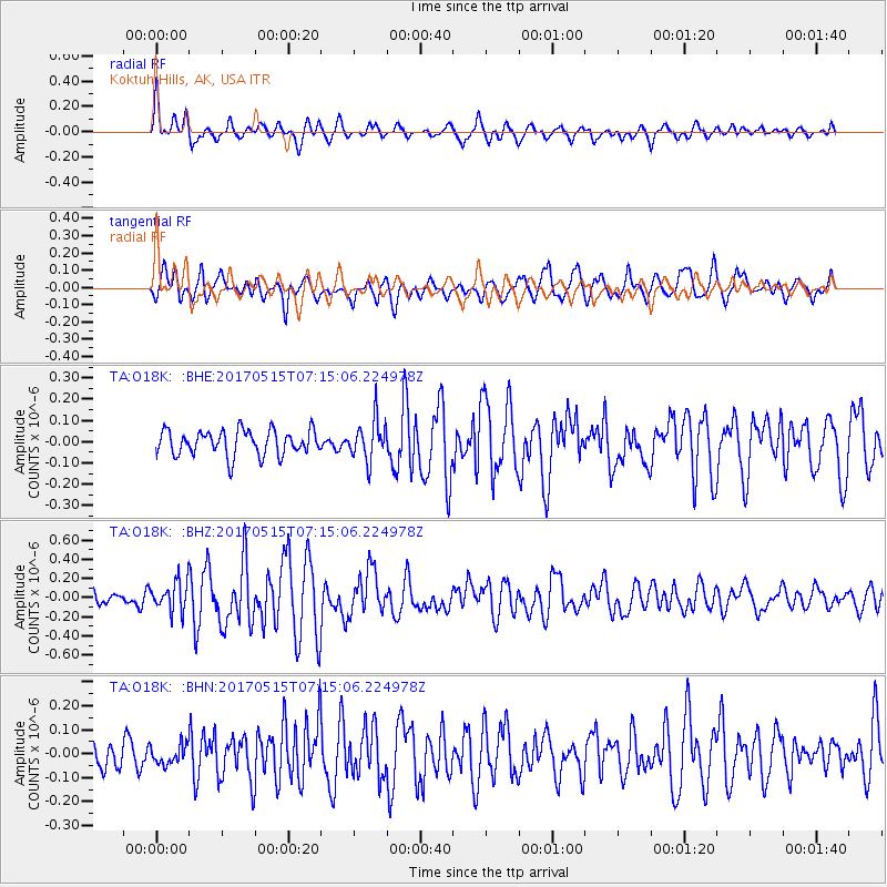
O18K Koktuh Hills, AK, USA - Earthquake Result Viewer
*The percent match for this event was below the threshold and hence no stack was calculated.
| Earthquake location: |
Ryukyu Islands, Japan |
| Earthquake latitude/longitude: |
27.2/130.2 |
| Earthquake time(UTC): |
2017/05/15 (135) 07:05:36 GMT |
| Earthquake Depth: |
10 km |
| Earthquake Magnitude: |
5.5 Mww |
| Earthquake Catalog/Contributor: |
NEIC PDE/us |
|
| Network: |
TA USArray Transportable Network (new EarthScope stations) |
| Station: |
O18K Koktuh Hills, AK, USA |
| Lat/Lon: |
59.85 N/155.21 W |
| Elevation: |
544 m |
|
| Distance: |
59.2 deg |
| Az: |
34.508 deg |
| Baz: |
271.732 deg |
| Ray Param: |
$rayparam |
*The percent match for this event was below the threshold and hence was not used in the summary stack. |
|
| Radial Match: |
72.12491 % |
| Radial Bump: |
400 |
| Transverse Match: |
66.5704 % |
| Transverse Bump: |
400 |
| SOD ConfigId: |
13570011 |
| Insert Time: |
2019-04-28 01:11:03.700 +0000 |
| GWidth: |
2.5 |
| Max Bumps: |
400 |
| Tol: |
0.001 |
|
Signal To Noise
| Channel | StoN | STA | LTA |
| TA:O18K: :BHZ:20170515T07:15:06.224978Z | 1.9862388 | 1.5845082E-7 | 7.97743E-8 |
| TA:O18K: :BHN:20170515T07:15:06.224978Z | 0.41078186 | 3.945375E-8 | 9.60455E-8 |
| TA:O18K: :BHE:20170515T07:15:06.224978Z | 1.6050234 | 9.474578E-8 | 5.903078E-8 |
| Arrivals |
| Ps | |
| PpPs | |
| PsPs/PpSs | |


