You are here: Home > Network List > TA - USArray Transportable Network (new EarthScope stations) Stations List
> Station P17K Kvichak River, AK, USA > Earthquake Result Viewer
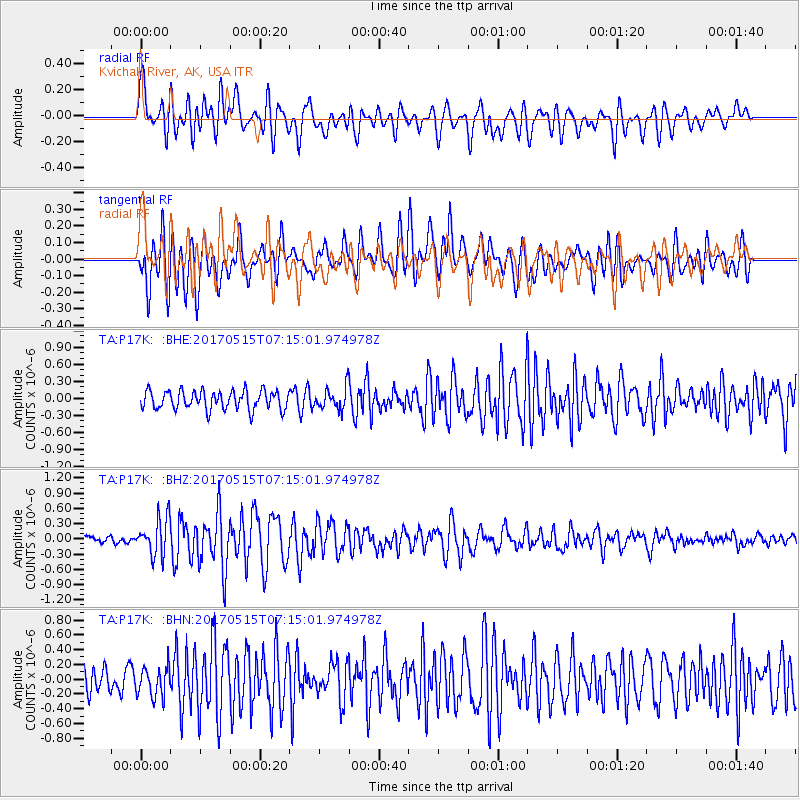
P17K Kvichak River, AK, USA - Earthquake Result Viewer
*The percent match for this event was below the threshold and hence no stack was calculated.
| Earthquake location: |
Ryukyu Islands, Japan |
| Earthquake latitude/longitude: |
27.2/130.2 |
| Earthquake time(UTC): |
2017/05/15 (135) 07:05:36 GMT |
| Earthquake Depth: |
10 km |
| Earthquake Magnitude: |
5.5 Mww |
| Earthquake Catalog/Contributor: |
NEIC PDE/us |
|
| Network: |
TA USArray Transportable Network (new EarthScope stations) |
| Station: |
P17K Kvichak River, AK, USA |
| Lat/Lon: |
59.20 N/156.44 W |
| Elevation: |
91 m |
|
| Distance: |
58.6 deg |
| Az: |
35.297 deg |
| Baz: |
271.08 deg |
| Ray Param: |
$rayparam |
*The percent match for this event was below the threshold and hence was not used in the summary stack. |
|
| Radial Match: |
77.565796 % |
| Radial Bump: |
400 |
| Transverse Match: |
71.58213 % |
| Transverse Bump: |
400 |
| SOD ConfigId: |
13570011 |
| Insert Time: |
2019-04-28 01:11:06.422 +0000 |
| GWidth: |
2.5 |
| Max Bumps: |
400 |
| Tol: |
0.001 |
|
Signal To Noise
| Channel | StoN | STA | LTA |
| TA:P17K: :BHZ:20170515T07:15:01.974978Z | 4.4538803 | 3.67109E-7 | 8.2424535E-8 |
| TA:P17K: :BHN:20170515T07:15:01.974978Z | 1.2345741 | 1.988425E-7 | 1.6106162E-7 |
| TA:P17K: :BHE:20170515T07:15:01.974978Z | 1.1510581 | 1.8888448E-7 | 1.640964E-7 |
| Arrivals |
| Ps | |
| PpPs | |
| PsPs/PpSs | |


