You are here: Home > Network List > TA - USArray Transportable Network (new EarthScope stations) Stations List
> Station G21K Allakaket, AK, USA > Earthquake Result Viewer
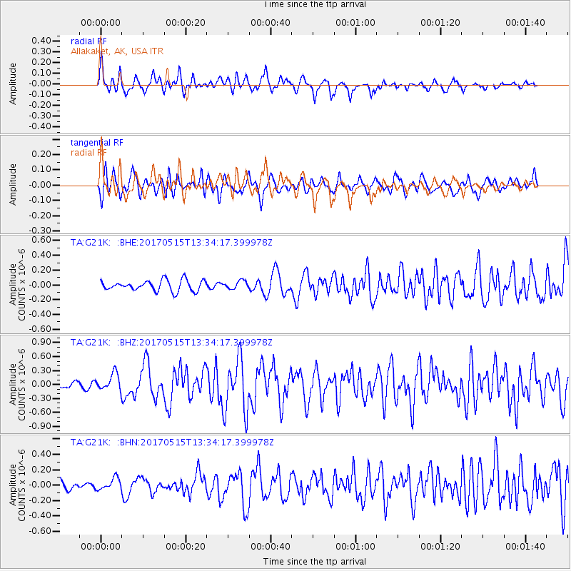
G21K Allakaket, AK, USA - Earthquake Result Viewer
*The percent match for this event was below the threshold and hence no stack was calculated.
| Earthquake location: |
New Britain Region, P.N.G. |
| Earthquake latitude/longitude: |
-4.0/152.5 |
| Earthquake time(UTC): |
2017/05/15 (135) 13:22:38 GMT |
| Earthquake Depth: |
10 km |
| Earthquake Magnitude: |
5.8 mb |
| Earthquake Catalog/Contributor: |
NEIC PDE/us |
|
| Network: |
TA USArray Transportable Network (new EarthScope stations) |
| Station: |
G21K Allakaket, AK, USA |
| Lat/Lon: |
66.52 N/153.51 W |
| Elevation: |
446 m |
|
| Distance: |
80.1 deg |
| Az: |
19.208 deg |
| Baz: |
234.98 deg |
| Ray Param: |
$rayparam |
*The percent match for this event was below the threshold and hence was not used in the summary stack. |
|
| Radial Match: |
78.641594 % |
| Radial Bump: |
400 |
| Transverse Match: |
71.94109 % |
| Transverse Bump: |
400 |
| SOD ConfigId: |
13570011 |
| Insert Time: |
2019-04-28 01:15:56.478 +0000 |
| GWidth: |
2.5 |
| Max Bumps: |
400 |
| Tol: |
0.001 |
|
Signal To Noise
| Channel | StoN | STA | LTA |
| TA:G21K: :BHZ:20170515T13:34:17.399978Z | 2.4745634 | 1.8545508E-7 | 7.4944566E-8 |
| TA:G21K: :BHN:20170515T13:34:17.399978Z | 0.86966455 | 7.8367876E-8 | 9.011276E-8 |
| TA:G21K: :BHE:20170515T13:34:17.399978Z | 0.76416075 | 5.5118953E-8 | 7.213005E-8 |
| Arrivals |
| Ps | |
| PpPs | |
| PsPs/PpSs | |


