You are here: Home > Network List > TA - USArray Transportable Network (new EarthScope stations) Stations List
> Station 131A Roby, TX, USA > Earthquake Result Viewer
131A Roby, TX, USA - Earthquake Result Viewer

| Earthquake location: |
Tonga Islands |
| Earthquake latitude/longitude: |
-20.8/-174.3 |
| Earthquake time(UTC): |
2009/07/30 (211) 20:05:34 GMT |
| Earthquake Depth: |
10 km |
| Earthquake Magnitude: |
5.9 MB, 5.7 MS, 5.8 MW, 5.7 MW |
| Earthquake Catalog/Contributor: |
WHDF/NEIC |
|
| Network: |
TA USArray Transportable Network (new EarthScope stations) |
| Station: |
131A Roby, TX, USA |
| Lat/Lon: |
32.67 N/100.39 W |
| Elevation: |
622 m |
|
| Distance: |
88.3 deg |
| Az: |
54.147 deg |
| Baz: |
244.008 deg |
| Ray Param: |
0.04266665 |
| Estimated Moho Depth: |
45.0 km |
| Estimated Crust Vp/Vs: |
1.64 |
| Assumed Crust Vp: |
6.426 km/s |
| Estimated Crust Vs: |
3.918 km/s |
| Estimated Crust Poisson's Ratio: |
0.20 |
|
| Radial Match: |
91.77909 % |
| Radial Bump: |
310 |
| Transverse Match: |
76.47387 % |
| Transverse Bump: |
400 |
| SOD ConfigId: |
2622 |
| Insert Time: |
2010-03-05 23:54:42.191 +0000 |
| GWidth: |
2.5 |
| Max Bumps: |
400 |
| Tol: |
0.001 |
|
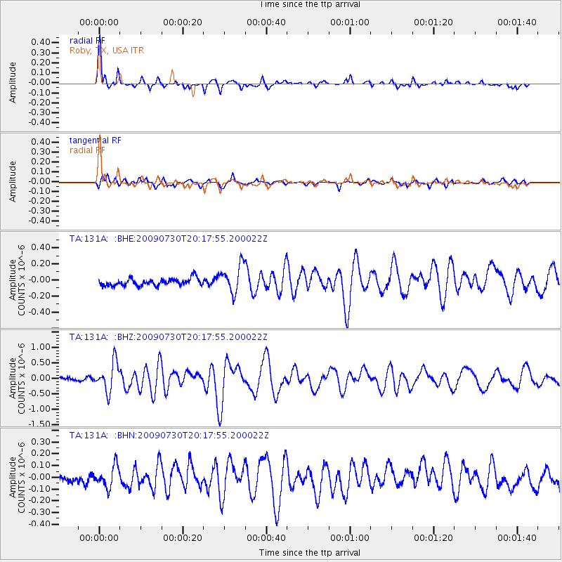
Signal To Noise
| Channel | StoN | STA | LTA |
| TA:131A: :BHZ:20090730T20:17:55.200022Z | 7.625931 | 4.8253276E-7 | 6.327526E-8 |
| TA:131A: :BHN:20090730T20:17:55.200022Z | 2.012349 | 9.3944735E-8 | 4.668412E-8 |
| TA:131A: :BHE:20090730T20:17:55.200022Z | 4.085101 | 1.8070011E-7 | 4.4233936E-8 |
| Arrivals |
| Ps | 4.6 SECOND |
| PpPs | 18 SECOND |
| PsPs/PpSs | 23 SECOND |


