You are here: Home > Network List > AK - Alaska Regional Network Stations List
> Station GAMB Gambell Broadband > Earthquake Result Viewer
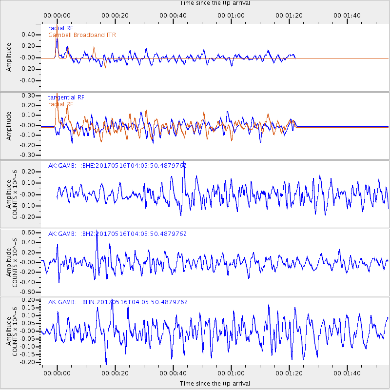
GAMB Gambell Broadband - Earthquake Result Viewer
*The percent match for this event was below the threshold and hence no stack was calculated.
| Earthquake location: |
South Of Mariana Islands |
| Earthquake latitude/longitude: |
12.4/145.1 |
| Earthquake time(UTC): |
2017/05/16 (136) 03:56:22 GMT |
| Earthquake Depth: |
40 km |
| Earthquake Magnitude: |
5.5 Mi |
| Earthquake Catalog/Contributor: |
NEIC PDE/pt |
|
| Network: |
AK Alaska Regional Network |
| Station: |
GAMB Gambell Broadband |
| Lat/Lon: |
63.78 N/171.70 W |
| Elevation: |
10 m |
|
| Distance: |
59.5 deg |
| Az: |
20.648 deg |
| Baz: |
230.853 deg |
| Ray Param: |
$rayparam |
*The percent match for this event was below the threshold and hence was not used in the summary stack. |
|
| Radial Match: |
59.868084 % |
| Radial Bump: |
400 |
| Transverse Match: |
53.115395 % |
| Transverse Bump: |
400 |
| SOD ConfigId: |
13570011 |
| Insert Time: |
2019-04-28 01:19:49.861 +0000 |
| GWidth: |
2.5 |
| Max Bumps: |
400 |
| Tol: |
0.001 |
|
Signal To Noise
| Channel | StoN | STA | LTA |
| AK:GAMB: :BHZ:20170516T04:05:50.487976Z | 1.9986116 | 1.4668187E-7 | 7.339189E-8 |
| AK:GAMB: :BHN:20170516T04:05:50.487976Z | 0.9516807 | 5.8389688E-8 | 6.135428E-8 |
| AK:GAMB: :BHE:20170516T04:05:50.487976Z | 1.2690158 | 5.6612283E-8 | 4.4611173E-8 |
| Arrivals |
| Ps | |
| PpPs | |
| PsPs/PpSs | |


