You are here: Home > Network List > AK - Alaska Regional Network Stations List
> Station MDM Murphy Dome > Earthquake Result Viewer
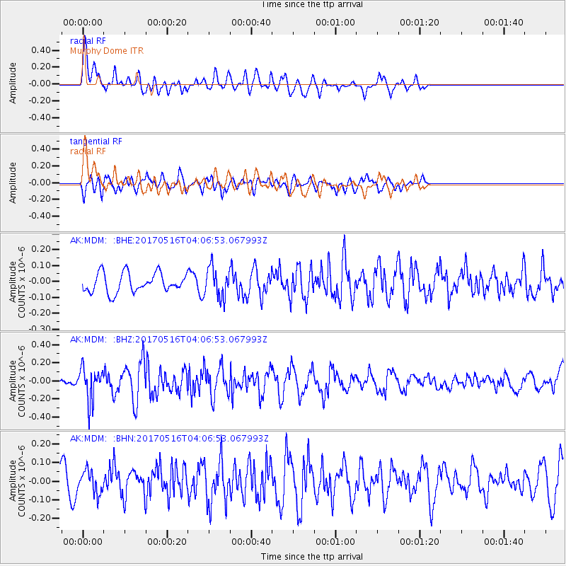
MDM Murphy Dome - Earthquake Result Viewer
*The percent match for this event was below the threshold and hence no stack was calculated.
| Earthquake location: |
South Of Mariana Islands |
| Earthquake latitude/longitude: |
12.4/145.1 |
| Earthquake time(UTC): |
2017/05/16 (136) 03:56:22 GMT |
| Earthquake Depth: |
40 km |
| Earthquake Magnitude: |
5.5 Mi |
| Earthquake Catalog/Contributor: |
NEIC PDE/pt |
|
| Network: |
AK Alaska Regional Network |
| Station: |
MDM Murphy Dome |
| Lat/Lon: |
64.96 N/148.23 W |
| Elevation: |
634 m |
|
| Distance: |
69.0 deg |
| Az: |
24.73 deg |
| Baz: |
253.824 deg |
| Ray Param: |
$rayparam |
*The percent match for this event was below the threshold and hence was not used in the summary stack. |
|
| Radial Match: |
60.142876 % |
| Radial Bump: |
400 |
| Transverse Match: |
61.694183 % |
| Transverse Bump: |
400 |
| SOD ConfigId: |
13570011 |
| Insert Time: |
2019-04-28 01:19:59.725 +0000 |
| GWidth: |
2.5 |
| Max Bumps: |
400 |
| Tol: |
0.001 |
|
Signal To Noise
| Channel | StoN | STA | LTA |
| AK:MDM: :BHZ:20170516T04:06:53.067993Z | 2.4620798 | 1.830829E-7 | 7.4361076E-8 |
| AK:MDM: :BHN:20170516T04:06:53.067993Z | 0.6768793 | 6.305255E-8 | 9.315185E-8 |
| AK:MDM: :BHE:20170516T04:06:53.067993Z | 1.5902364 | 9.5278516E-8 | 5.991468E-8 |
| Arrivals |
| Ps | |
| PpPs | |
| PsPs/PpSs | |


