You are here: Home > Network List > CI - Caltech Regional Seismic Network Stations List
> Station MUR Murrieta > Earthquake Result Viewer
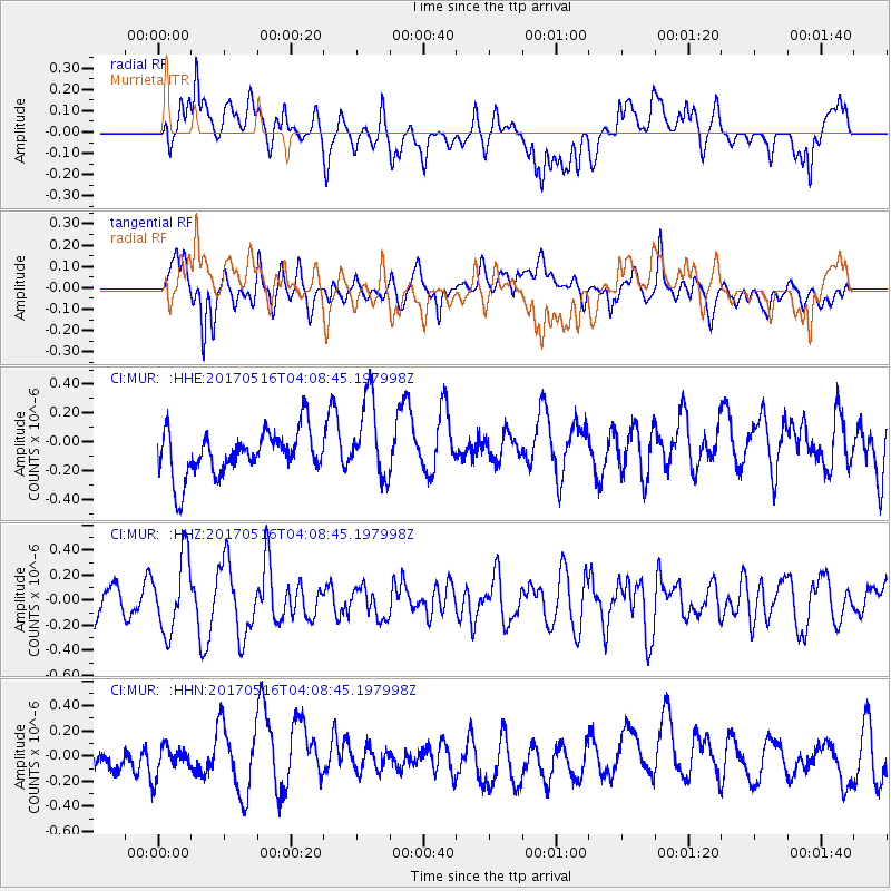
MUR Murrieta - Earthquake Result Viewer
*The percent match for this event was below the threshold and hence no stack was calculated.
| Earthquake location: |
South Of Mariana Islands |
| Earthquake latitude/longitude: |
12.4/145.1 |
| Earthquake time(UTC): |
2017/05/16 (136) 03:56:22 GMT |
| Earthquake Depth: |
40 km |
| Earthquake Magnitude: |
5.5 Mi |
| Earthquake Catalog/Contributor: |
NEIC PDE/pt |
|
| Network: |
CI Caltech Regional Seismic Network |
| Station: |
MUR Murrieta |
| Lat/Lon: |
33.60 N/117.20 W |
| Elevation: |
562 m |
|
| Distance: |
89.5 deg |
| Az: |
55.813 deg |
| Baz: |
284.444 deg |
| Ray Param: |
$rayparam |
*The percent match for this event was below the threshold and hence was not used in the summary stack. |
|
| Radial Match: |
53.640877 % |
| Radial Bump: |
400 |
| Transverse Match: |
59.707787 % |
| Transverse Bump: |
400 |
| SOD ConfigId: |
13570011 |
| Insert Time: |
2019-04-28 01:21:27.001 +0000 |
| GWidth: |
2.5 |
| Max Bumps: |
400 |
| Tol: |
0.001 |
|
Signal To Noise
| Channel | StoN | STA | LTA |
| CI:MUR: :HHZ:20170516T04:08:45.197998Z | 1.4686397 | 2.9283336E-7 | 1.9939088E-7 |
| CI:MUR: :HHN:20170516T04:08:45.197998Z | 0.94537526 | 1.1979837E-7 | 1.2672044E-7 |
| CI:MUR: :HHE:20170516T04:08:45.197998Z | 1.6521982 | 2.625917E-7 | 1.5893474E-7 |
| Arrivals |
| Ps | |
| PpPs | |
| PsPs/PpSs | |


