You are here: Home > Network List > TA - USArray Transportable Network (new EarthScope stations) Stations List
> Station 131A Roby, TX, USA > Earthquake Result Viewer
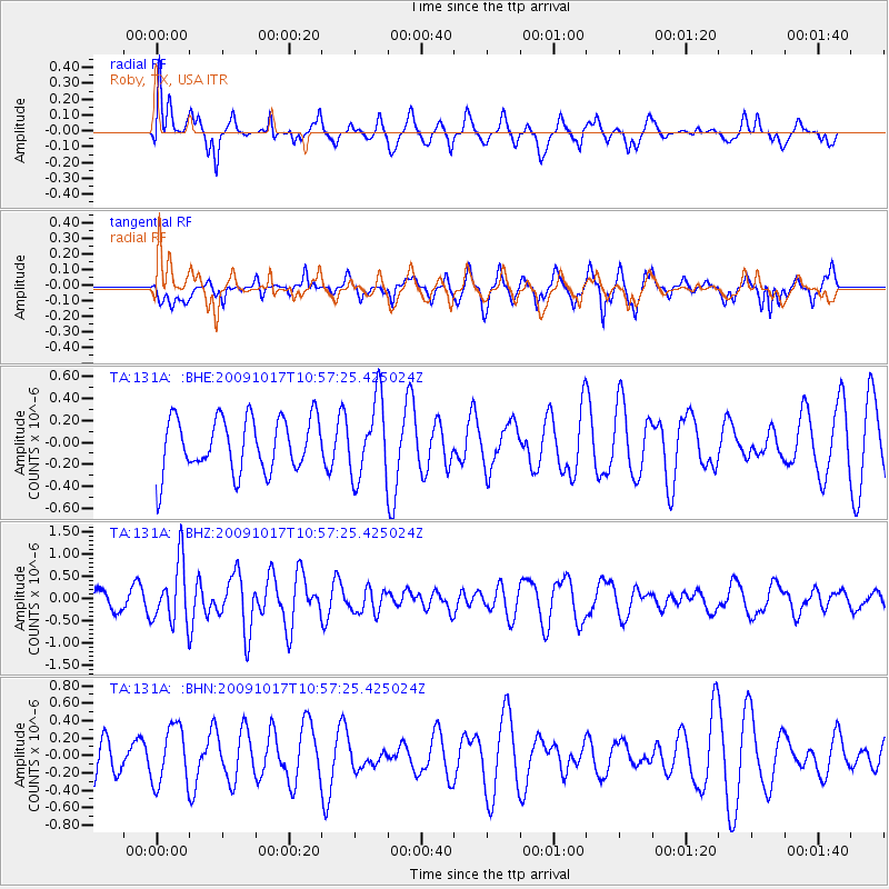
131A Roby, TX, USA - Earthquake Result Viewer
*The percent match for this event was below the threshold and hence no stack was calculated.
| Earthquake location: |
Samoa Islands Region |
| Earthquake latitude/longitude: |
-16.4/-172.0 |
| Earthquake time(UTC): |
2009/10/17 (290) 10:45:26 GMT |
| Earthquake Depth: |
10 km |
| Earthquake Magnitude: |
5.7 MB, 5.3 MS, 5.7 MW, 5.7 MW |
| Earthquake Catalog/Contributor: |
WHDF/NEIC |
|
| Network: |
TA USArray Transportable Network (new EarthScope stations) |
| Station: |
131A Roby, TX, USA |
| Lat/Lon: |
32.67 N/100.39 W |
| Elevation: |
622 m |
|
| Distance: |
84.0 deg |
| Az: |
53.585 deg |
| Baz: |
246.346 deg |
| Ray Param: |
$rayparam |
*The percent match for this event was below the threshold and hence was not used in the summary stack. |
|
| Radial Match: |
65.72254 % |
| Radial Bump: |
400 |
| Transverse Match: |
44.468544 % |
| Transverse Bump: |
341 |
| SOD ConfigId: |
2622 |
| Insert Time: |
2010-03-05 23:55:31.318 +0000 |
| GWidth: |
2.5 |
| Max Bumps: |
400 |
| Tol: |
0.001 |
|
Signal To Noise
| Channel | StoN | STA | LTA |
| TA:131A: :BHZ:20091017T10:57:25.425024Z | 3.6476538 | 6.8529806E-7 | 1.8787365E-7 |
| TA:131A: :BHN:20091017T10:57:25.425024Z | 1.0280193 | 3.3328163E-7 | 3.2419783E-7 |
| TA:131A: :BHE:20091017T10:57:25.425024Z | 1.4595629 | 3.5398313E-7 | 2.425268E-7 |
| Arrivals |
| Ps | |
| PpPs | |
| PsPs/PpSs | |


